Green Spring Gardens Seeks Field Trip Leaders

Green Spring Gardens
4603 Green Spring Road, Alexandria VA

Sign up here.

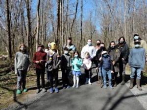
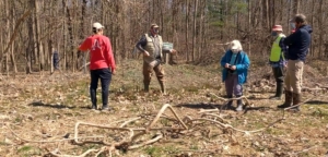
The Youth and Family Education Program Coordinator at Green Spring Gardens is seeking volunteers to serve as teachers for school field trips visiting the Gardens. The field trips are two hours each and run through the school year. View the descriptions of the field trips here.

The confirmed schedule of 2022-2023 field trips is here to check the dates and to sign up. This is also where anyone can sign up to observe a field trip to show how it operates before committing to lead a station.

Questions? Contact Bailey Price at [email protected] or (703) 642-5173.

Triassic Rocks of Horsepen Run

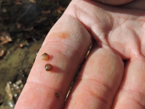
Muscovite mica glitter is apparent in a rock sample from Horsepen Run.

Article and photos by FMN Stephen Tzikas

Part of the Horsepen Run watershed is located in the northwestern part of Fairfax County. Horsepen Run eventually drains into the Potomac River. The trail that follows the creek in the watershed is popular with county residents. A part of the creek is also one of the regular sites of biological stream monitoring, a volunteer citizen science program managed by the Northern Virginia Soil and Water Conservation District. What a lot of people don’t know is that Horsepen Run is home to some interesting Triassic Period rocks, formed some 200 to 250 million years ago. A few years ago I participated in a geological field trip excursion as part of a NVCC 1-day 1-credit course that explored the geologic history of Mesozoic Era rift basin across the Manassas, Leesburg, and Haymarket areas. The excursion was specific to the Triassic and Jurassic Periods. Specific items of interest were the weathering of products; direction of transport; sediment structures; igneous rock textures and their cooling history, the rock cycle, and plate tectonics.

One of the sites investigated was the Dulles Access Road East “utility” off-road on the exit ramp for Rt. 28, at Horsepen Run. This site was the central point of a rift valley deep with sediments. Specifically, it was a lake bottom of red sediment. Some shale exists, breaking into sheets and fine grain. The rift was formed when the Earth

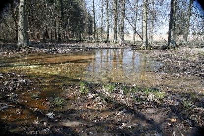
Horsepen Run creek at this location is composed of characteristic red rock: TRb Balls Bluff siltstone, both creek bottom and the adjacent 1-2 foot walls.

was pulled apart at the location. The rift valley is the linear shaped lowland between higher hilly and mountainous elevations created by the action of a geologic rift. Such valleys are likely to be filled with sedimentary deposits derived from the rift flanks and the surrounding areas. At this location the rock type contains Upper Triassic Balls Bluff Siltstone baked and thermally altered material. The red sediment at the location is obvious and contrasts with the appearance further upstream. The glitter found in the red rocks at this location are tiny fragments of mica.

In the Triassic Period, this site was tranquil and sediments came to rest. At the Horsepen Run area, bubbles on the surface of the sediment rock indicate a calcareous (calcium based) dissolved appearance where the red rock voids still have some calcium carbonate (scattered white tones on the rocks). Occasional storms brought water from outlying edges to the center and carried some coarser material. A storm deposit from the west could bring calcium carbonate from the Leesburg conglomerate. A storm deposit episode or event could last minutes to hours.

The lacustrine (lake) facies indicated an oxygen rich environment with red color clastic deposits, allowing the oxidation of the iron. This is facies evidence, referencing the look of rock to respect of environment. If there was no oxygen we would have found black shale. Low energy would have been required for the fine grain to come to rest. Fine grains could also be due to a deep environment, but here it was more likely a shallow one of 10-15 feet, where sediments could dry. This area was a cove of low energy closed lake basin water, subject to evaporation effects. Some “circle fossil” burrow tubes also exist in the fine grain clays. Burrowing organisms lived here causing bioturbation. More evidence of the oxygen rich condition is that the taphonomic conditions were not ideal for preservation, as oxygen rich area deaths led to scavenging and organic breakdown. The terraced layers at the site alternated between siltstone and claystone, caused by changes of energy due to rainfall and climate. Higher energy means more shallow depth silt: wave energy takes away clay silt by the beach. If the climate was a little dryer, the lake would shrink, alternating between shallow and deeper cycles. These climatic cycles were tied to the Milankovitch cycles of variations in the Earth’s eccentricity, axial tilt, and precession.

You also might find some of the glittery red rocks in the surrounding area near Horsepen Run. Recently I visited the EatLoco Farmers Market at One Loudoun near Dulles airport. Between the parking lot and the vendor stalls is a strip of ground, part grassy and part flat thin red rock chips, not unlike what is found at the Horsepen Run site.

Earth Sangha Nursery Workdays in November

Photo:  Earth Sangha

Sundays, Mondays and Tuesdays
9 am – Noon
6100 Cloud Dr, Springfield, VA 22150
Sign up here.

Help the Earth Sangha team with fall season tasks. They need help with potting, weeding, sowing seeds and winterizing. They’ll provide tools and gloves. Please dress for the weather, wear sturdy shoes, and bring your own water. If you arrive late, please call Sarah at 580-583-8065.

Fairfax County Park Authority, Dark Skies’ Webpage

Photo/Image: Courtesy of Fairfax County Park Authority

WHAT IS LIGHT POLLUTION?

Light Pollution is defined by the International Dark Sky Association as the inappropriate or excessive use of artificial light which can have serious environmental consequences for humans, wildlife, and our climate. It’s caused by the excessive and inefficient use of artificial light at night.

This webpage provides detailed information on a variety of topics related to light pollution.

A sample of the site’s contents are listed below:
  • LIGHT POLLUTION COMPONENTS
  • EFFECTS OF LIGHT POLLUTION
  • THE IMPORTANCE OF DARK SKY CONSERVATION EFFORTS
  • TIPS:  WHAT YOU CAN DO TO HELP
  • DARK SKY FRIENDLY OUTDOOR LIGHTING PRINCIPLES

Please take some time to browse through this very informative and comprehensive website,

McLean Gears Up for Dark Sky Celebration, November 12th

Photo: Courtesy of Fairfax County Park Authority

Saturday, Nov. 12, 2022
6:30pm – 8:30pm

Lewinsville Historic House
1659 Chain Bridge Road
McLean, Virginia 22101

Register here.


Dark skies are the natural state of nature. Over time, humans have increased the amount of light shining into the sky all night long. This excessive light has robbed us of the glimpse of our stars and endangered the natural world around us. We can have dark skies again if we learn to control light pollution with responsible outdoor lighting practices.

The Fairfax County Park Authority is partnering with the McLean Citizens Association, Dark Sky Friends and the Analemma Society to host a celebration of the importance of dark skies.

Come to the historic house in Lewinsville Park on Saturday, Nov. 12, 2022, to learn about the importance of dark skies in your community. The free event will have hands-on activities and educational opportunities about how to protect the night sky. Learn about nighttime wildlife and constellations. Come experience the night with us and enjoy a small campfire and cocoa. The event runs from 6:30 until 8:30 p.m.

There is no cost to the “Dark Sky Celebration” program, and registration is not required but is encouraged. By signing up, we can notify you in case of inclement weather. The rain date is the following day on Sunday, Nov. 13, 2022.

To learn more about the importance of dark skies, visit the Dark Skies webpage.

State of the Birds 2022 in Northern Virginia, Audubon Society of Northern Virginia

Photo: Chimney Swifts, Gen Cvengros, Audubon Photography Awards

Following a 2019 report that we have lost 3 billion birds in 50 years in the United States and Canada, the national State of the Birds Report 2022 (released on October 12, 2022) shows that birds are declining in every habitat except wetlands, where 30+ years of conservation investment have paid off.

To see the national report, visit StateoftheBirds.org.

Here in northern Virginia, we have also lost many birds. Urban and suburban areas pose special threats to birds, including habitat loss, window and other collisions, and the spread of invasive species, including plants, insect pests, and outdoor cats.

In the face of these losses, there are many things we can do to promote bird conservation. ASNV’s Audubon at Home program advises homeowners on replacing invasive plants with natives. In addition, we advise park managers on how to manage parks for breeding birds, especially grasslands and meadows that support declining species such as Eastern Meadowlarks and American Kestrels.

The new State of the Birds report identifies 90 species that have declined more than 50% in the past 50 years. Of those species, five breed in northern Virginia and should be a special focus of conservation efforts here:

  • Chimney Swift – You can help ASNV protect swifts by letting us know if you have breeding swifts or a fall roosting congregation.
  • Wood Thrush and Red-headed Woodpecker – These birds need healthy forests to breed successfully.
  • Prairie Warbler – This is a species that needs overgrown meadows with Eastern red cedars.
  • King Rail – This a secretive wetland bird that often breeds in Occoquan Bay National Wildlife Refuge and occasionally in other wetlands nearby.

In addition to these five, our region supports important populations of migrating birds in spring and fall. These birds use small parks and even backyards while traveling on their perilous journeys, so everything we do to improve our local environment can make a big difference!

Audubon Society of Northern Virginia

A Year in the Life of an Owl, November 2nd

Photo: Courtesy of the Loudoun Wildlife Conservancy

Wednesday, November 2, 2022
7:00 pm

Rust Library
380 Old Waterford Rd NW
Leesburg, VA + Google Map

Click here for more information.

Join Liz Dennison of Secret Garden Birds and Bees to follow the region’s four resident owls from winter through fall. You’ll learn what makes owls instantly recognizable and find a few surprises hidden under all those feathers! You’ll get a peek into their romantic courtships, the challenges of raising young, and the difficult transition from nestling to fledgling. And finally, you will see the quiet time when the young seek out their place in the world and the adults can (almost) relax. Four Owl Ambassadors will help Liz tell the story. You’ll meet Scarlett (Barred Owl), Hodor (Great Horned Owl), Phantom (Barn Owl), and Kvosir (Eastern Screech Owl) in the flesh, learn about each species and a little about their personal lives in captivity. You might even get to take a few selfies! This program is co-sponsored by Loudoun Wildlife Conservancy and the Loudoun County Public Library.

Winter Seed Sowing with Laura Beaty and Donna Murphy, November 1st

Tuesday, November 1, 2022
7 -8 pm
Virtual
ASNV Member Ticket: $10
Non-member ticket: $15
Register here.

Audubon Society of Northern Virginia wants to know: Do you want a garden brimming with life for a fraction of the price you’d pay to install full-grown plants? Learn how to propagate native plants from seed with this helpful tutorial. Now is the time to collect and sow seeds in trays of seed-starter medium for over-wintering and sprouting seedlings in the spring and summer. Laura Beaty and Donna Murphy will recommend seed sources, share helpful tips and tricks, and answer questions from the audience.

Meadowood Partnership

(Cover photo Jerry Nissley)

FMN recently established a partnership with Meadowood Special Recreation Management Area on Mason Neck Peninsula (SRMA). The Bureau of Land Management (BLM) Eastern States Lower Potomac Field Station manages recreation and natural resources on two properties, one in Maryland and the other in Virginia. The Meadowood Special Recreation Management Area (SRMA) includes 800 acres on the Mason Neck Peninsula in Fairfax County, Virginia, is located just 25 miles south of Washington, D.C. Mason Neck State Park, Pohick Bay Regional Park, Elizabeth Hartwell Mason Neck National Wildlife Refuge, and Gunston Hall historic mansion are also located on the peninsula. The peninsula is formed by Gunston Bay to the north, Potomac River to the east, and Belmont Bay to the south.

Morning Meadow (courtesy BLM)

The SRMA landscape contains a variety of terrains and vegetation types. These include gently sloping open meadows, mature hardwood forests along steep slopes, floodplains, and riparian areas, as well as freshwater ponds and streams. Red and white oak, beech, sweet gum, Virginia pine, and persimmon, which are common sights in mid-Atlantic woodlands, appear throughout the forests at Meadowood. The ponds, streams and riparian areas in the SRMA host a wide variety of insects, fish and other wildlife.

Veterans group, Fishing Community Org (FCO), ‘Fishing On Public Lands’ Event (photo Jerry Nissley)

BLM and the State of Virginia survey the population in the fishing ponds periodically, and restock them when needed. Grass-eating carp are among the species stocked in the ponds; they cannot reproduce, and they eat invasive aquatic weeds, which would otherwise overwhelm small ponds. In addition to stocked species, the American eel appears in the area’s ponds and streams and serves as an attractant to the local Bald eagles. Migrating waterfowl such as various ducks species, Canada geese, egrets, and herons commonly occur at water features. Dragonflies and butterflies are abundant at and near the ponds and meadows. Whitetail deer, Fox squirrels, Red fox, and coyotes abound throughout Meadowood. Moreover, the North American beaver makes the occasional appearance in the floodplains of Thompson Creek, Giles Run and South Branch as well as at Enchanted Pond.

Mountain bike trail ramp (courtesy BLM)

Miles of well marked multi-use trails (courtesy BLM)

Equestrian competition (photo Jerry Nissley)

The Meadowood Area encompasses 13.4 miles of hiking trails, 7 miles of horseback riding trails, 6.6 miles of mountain biking trails, and a large equestrian center. Meadowood hosts a universally accessible trail to two fishing ponds, 800 acres of forest and meadows, environmental education programs, horse boarding stable, geocaching, picnic areas, and bird watching sites. Portions of both the Washington-Rochambeau National Historic Trail and the Potomac Heritage National Scenic Trail wind their way through the managed hiking area.

The environmental education programs are developed for homeschoolers, public and private schools, local 4-H groups, and community agencies. Programs consist of bird identification, fishing, habitat hikes, tree identification, Urban Leave No Trace, tracking, invasive weed removal, clean-up days, and many other outdoor environmental educational activities.

FMN/BLM tree planting team. National Public Lands Day. (Courtesy Ryan Sierra Jackson)

In conjunction with National Public Land Day, FMN helped the Meadowood team in our inaugural service project with them by planting trees and shrubs, trimming the pollinator garden, and general landscape maintenance  around the Mustang Trailhead pavilion. Thank you to FMN volunteers Monica Hoffman, Amy Eisenmenger and her husband, and Steve Tryon and his wife for pitching in. Future service opportunities will present themselves so be sure watch for FMN announcements. Please contact Meadowood directly to inquire about open volunteer opportunities or becoming a regular volunteer. Ryan Sierra Jackson at [email protected] is the volunteer coordinator.

FMN welcome’s Meadowood as a chapter partner and created both a Service Code and a CE code for future opportunities.

Service hours may be entered under – S175: Meadowood SRMA Service Projects – – Bureau of Land Management

CE hours may be entered using the category All Continuing Education and then Bureau of Land Managment as the approved CE organization. Please enter project description and/or CE title when recording hours.

Plant NOVA Trees — One Year On

September marks the first anniversary of the launch of Plant NOVA Trees, a regionwide effort by over a hundred local organizations and thousands of individuals to promote native trees and shrubs in Northern Virginia. There is no regional tree planting agency that can do the job for us. Rather, it is up to each individual to look around to see how they can contribute, at home, at work, or on common land. Plant NOVA Trees connects people to the resources they need to do that.

There are many ways to participate. The simplest is to identify every appropriate site and plant young trees or shrubs there now, preferably canopy trees if there is room. They may not look like much the first couple years, but soon they will grow and provide shade and cooling for humans as well as shelter and food for our birds and butterflies. Information on how to choose and plant a native tree or shrub is available on the Plant NOVA Trees website. Fifty volunteers have visited local garden centers to hang thousands of tags on the native trees, making them easy to identify. (The same volunteers have been putting red stickers on all the native plants in those garden centers for several years.)

Each of our local jurisdictions and park services has tree planting plans for public lands. For example, the Prince William Soil and Conservation District has been working with 3rd and 4th graders to plant trees on school grounds. Kudos go especially to Purcellville, which planted 118,100 trees last year on former farmland that is owned by the town.

Members of local communities have also gotten together to plant trees in their common areas and to help residents plant on their own properties. So far, residents have self-reported 7850 trees and shrubs  on the Plant NOVA Trees website form. The Virginia Department of Forestry is collecting these figures as it works to meet its goal of 600,000 planted in Northern Virginia by 2025. This number is intended to help our region meet its obligation to protect the Chesapeake Bay, since runoff from roofs, roads and empty lawns is causing damage downstream, and trees are nature’s tool for capturing water. Those who appreciate our waterways should give careful thought to how they can contain stormwater on their own properties before it rushes off to erode our streams and dump sediment and pollutants into the Bay.

Despite all these efforts, Northern Virginia is gradually losing tree canopy. Multiple factors contribute to tree death. Some are hard to change on a local level, such as the stress on trees from climate change. Others are absolutely within our control, such as poor planting and mulching practices or the sacrifice of trees for more roads, buildings, and park amenities. Each native tree lost is one less home for birds and other wildlife as our local ecosystem suffers its death from a thousand cuts.

Invasive vines (as opposed to the beneficial native vines) pose another important threat to trees, and this has become one of the foci of the Plant NOVA Trees campaign. Volunteers for the new Tree Rescuers program spot trees that are at risk from English Ivy, Asian Wisteria, or other invasive non-native vines and drop off literature with the owners to alert them to the easily-mitigated problem. While they are at it, the volunteers count the trees at risk so we can get a more precise handle on where resources should be concentrated. So far, over two hundred volunteers have alerted 799 residents to 3491 trees at risk in 4.2 square miles of residential properties. In addition, they have counted almost 22,000 trees at risk in 3.3 square miles of non-residential areas. The data collection is too preliminary to make an accurate extrapolation, but it would appear that the total number of trees in need of rescue in Northern Virginia’s 1,300 square miles may be in the millions.

There are numerous opportunities around Northern Virginia to help control these invasive vines by cutting them near the ground. Over 3500 trees have been reported as saved so far. Besides saving the trees on their own properties, volunteers can organize the work on common land within their communities or join the invasives management programs of the various park services, listed on the Plant NOVA Trees “Rescuing Trees” page. Residents and communities can obtain a permit to clip the vines on VDOT property. In general, though, the resources to control invasives on government-owned land and easements will need to come from the governments themselves (and ultimately from the taxpayers.) It is also critical that everyone stop planting invasive plants to begin with, not only the invasive vines but all the other invasive non-native landscaping plants such as Bradford Pears and Burning Bush that escape from our properties into natural areas.

Businesses have been helping with the regional tree campaign in several ways. Local garden centers are promoting native trees and shrubs in honor of Celebrate Native Trees Week (Sept 26-Oct 2). Landscaping companies are increasingly choosing native species,  and a few have started to offer invasive plant removal services. Any company could educate its employees and customers and provide financial support to neighborhoods that need help with their open spaces.

Those businesses that control property can plant and preserve native trees there, which in some places may mean tearing up concrete to make room.

So what can you do to support the native tree campaign? Plant NOVA Trees is essentially an educational organization. The success of this initiative depends on the individual efforts of residents  across the region. So what can you do to support the native tree campaign? Plant NOVA Trees is essentially an educational organization. The success of this initiative depends on the individual efforts of residents across the region. There is no shortage of ideas on how to get involved, whether where you live or work or on a wider scale. Find these ideas on the Plant NOVA Trees website.