Quarries Offer Geologic Explorations

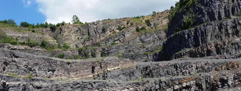
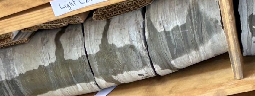
Feature photo: Luck Stone Quarry. Tilted Upwards Rock layering. Not shown is the East side folding, and a fault at the north metamorphic boundary

Photos and article by FMN Stephen Tzikas

Mining operations are inherent to the disciplines of geology and engineering.  Mines can be open pit (surface), or underground.  They can include minerals, coal, and other valuable products. There are opportunities as an FMN to explore quarries in the vicinity and on vacations.  These can be individual visits if open to the public, or part of excursions hosted by universities, professional organizations or amateur geology/mineral clubs.  The first two locations that I note here are from sites included in a Norther Virginia Community College (NVCC) 1 credit course called Triassic-Jurassic Rifting of North America: Geological Field Studies Trip to the Triassic Lowlands of Northern Virginia, which occurred on June 24, 2017. This course explored the geologic history of Mesozoic Era rift basin across the Manassas, Leesburg, and Haymarket areas.  The trip was specific to the Triassic and Jurassic Periods.

At the east side of Luck Stone Diabase Quarry in Centreville, are the igneous rocks. On the west

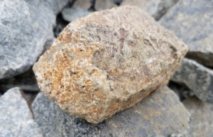
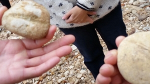
Manassas Quarry. This quarry excursion was organized by the Mineralogical Society of the District of Columbia (MSDC).  Shown here is a close-up of a hand-sized rock sample containing stilbite crystals, from the Vulcan Quarry in Manassas.  One might also find stellerite, calcite, prehnite, laumontite, chalcopyrite, and chalcedony in this quarry.

side of the quarry are deposited layered sedimentary rocks.  On the north side, in the past, the igneous rocks rammed into the sedimentary rocks and thermally altered them, forming metamorphic rocks by contact metamorphism. The sedimentary rocks are Balls Bluff siltstone, of about 205 million years of age at the end of Triassic.  The light green color layers are more coarse; while darker, purple, red, and lavender hues are finer. The igneous rock originated in a magma chamber from early rifting.  They are an intrusive Jurassic diabase. The red upper color layer is iron rich. This upper most part was oxidized to the air due to its longest exposure time.  The diabase is a dark pyroxene, iron augite.  The light color is a plagioclase feldspar, of a high temperature igneous rock close to the Earth’s mantle. As a magma chamber cooled, there is a magmatic differentiation where the magnesium and calcium minerals settled first.  As the crystals settled they evolved more light in color, and are less mafic. Later the residual melt was more felsic as it flowed through dykes.

About 205 million years ago the mantle bowed up the Earth’s crust.  Rift lakes were created in the Triassic lowlands. They were filled with sediments.  However, the rift basin didn’t open completely, leading to a graben central valley, and the horst mountain area.  The slow cooling of the magma chamber created large crystals.  The NVCC field excursion also discussed many other minerals and structures and how they were formed.  The vegetation on rocks in the quarry are indicative of the minerals present, i.e., calcium loving plants.

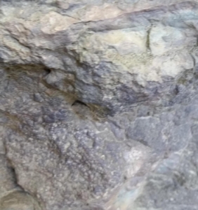
Close-up of Mount Zion Church basalt, 6×6 inch scale, at the Abandoned Haymarket Quarry.  This photograph shows a porous “knob” of the basalt (lower) and a sediment infiltrated crack (upper).


At the abandoned Haymarket Quarry, Antioch Road (Silver Lake Regional Park), we observed extruded surface lava.  The rock type encountered here is gray Lower Jurassic Mt. Zion Church Basalt with an inter-bedded Turkey Run Formation. In the Jurassic time some diabase broke out into iron and magnesium flood basalts, sourced from the upper mantle mafic. A vast outpouring occurred into this old river valley.  This flood basalt had little silica in it, so it flowed easily (in contrast to having silica to make it resistant to flow).  Gas bubbles of water/sulfur gas escaped out from a porous/ pitted vesicular texture.  Sediment filled into the cracks and old basalt flow bubbles.  The basalt is porous, the sediment red. This Mid-Atlantic rift event petered out.  After 200 million years of weathering the tough basalt (which filled the valley) formed a topographic inversion, where the surrounding softer rock weathered away.

Pollinator Pathways Turn One in Northern Virginia

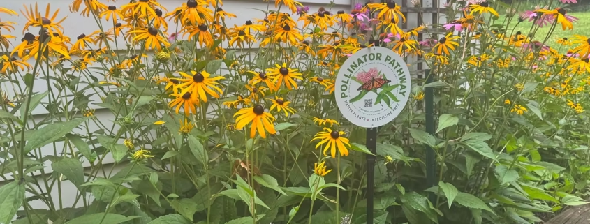
Photo: Plant NOVA Natives

Article by Eileen Ellsworth

One year ago, Plant NOVA Natives launched a Pollinator Pathway initiative. The original program was created by a group of highly credentialed environmentalists and conservationists in Wilton, Connecticut and expanded by PNN into Northern Virginia. Its goal is to address habitat fragmentation caused by human activity that has drastically reduced insect populations and degraded the environment. The program suggests ways a community, working together, could create “stepping stones” of native plants to connect these isolated fragments and build a feeding/sheltering/hosting corridor that insects can find and follow.

As a result of the Pollinator Pathway launch, several neighborhoods across the region took steps to build one. Many more native plants ended up in the ground, all of them strategically placed to help local pollinators find sources of food and shelter they so desperately need. Here are some highlights from the past year that may motivate action going forward.
You may recall that the program has two requirements for membership. First, have an existing native tree or a native plant pollinator garden on your property. Second, avoid the use of all broadcast pesticides, including mosquito fogging, which kills every native insect it touches – except the mosquitos’ own larvae! Those happily grow and hatch away in standing water, unfazed by the chemical.
With these requirements in mind, several people in Fairfax and Arlington set out to start pathways, using the Pollinator Pathway signs to help attract interest. There have been many reports of curious neighbors and passers-by who stopped to inquire about the initiative. While the signs certainly helped educate, the program also fostered a deeper sense of community and a growing energy around the program’s goal.
For example, Margaret Fisher created a Pollinator Pathway in Clifton. She says, “It couldn’t have been easier. I had already gone door-to-door ten years ago or so to sign neighbors up for a ‘Bee Safe Neighborhood,’ where people pledged not to use neonicotinoid insecticides outdoors. We celebrated our neighborhood with a very fun block party. I have email addresses for some of those folks and was able to easily convince them to sign up for the Pollinator Pathway. The properties lead more or less contiguously to Chapel Road Park. Very few people in our area use mosquito spraying services, and I hope seeing the signs along the road may prompt them to cancel those services.”
Melania Flores took advantage of an existing effort to plant more canopy trees in her Ashton Heights neighborhood. She reached out to that group, giving her access to a wider neighborhood audience. She knocked on doors, created and printed flyers, and presented the topic at one of the monthly Ashton Heights Civic Association (AHCA) meetings. She also started writing a monthly article for her neighborhood newsletter to further engage and educate. All told, her efforts have garnered 24 Pollinator Pathway participants to date, and that number is growing. All of them have signs that broadcast the program. Melania has been invited to neighbors’ homes and the local church to consult on how they can help. She even offered some of her own native plants as a benefit of joining. And lastly, the entire neighboring community organized a “buckets of doom” initiative with mosquito dunks to help control mosquitos in an effective, environmentally friendly manner.

Sara Holtz recruited 95 properties to the effort, including parks in the Town of Vienna and Fairfax City. She tapped several friends and neighbors in the Miller Heights neighborhood of Oakton and conducted tabling efforts at events hosted by the Vienna Farmer’s Market, the Virginia Department of Forestry, and the Greater Oakton Community Association. She contacted Supervisor Dalia Palchik, Delegate Holly Seibold, and School Board member Melanie Meren to put signs in their gardens. Some local elected officials also promoted the endeavor in their newsletters at her request. The owner of The Virginian Restaurant agreed to put a sign in his garden next to the restaurant. She posted on the Native Vienna Facebook group reaching all homeowners who follow it. Many hundreds of local property owners were engaged and educated through her efforts.

Constance Chubb and Melinda Soltys both rallied their neighbors and friends, grew the program’s membership, and gave away many plants and signs. As for me, I also created a street-based initiative, recruiting eight friends and neighbors to join and display signs. In addition to planting more natives on our own properties, we coordinated on non-native invasive removal efforts in the community-owned park – a collection of wooded parcels that weave between our homes and throughout the neighborhood. Finally, we built a new, very visible pollinator garden on a street-side plot of mowed Japanese stilt grass. Figured we couldn’t go wrong with that one.
Turns out the effort can be as small or as large as you personally choose to make it. The goal is not a perfect carpet of native plants that stretches down the entire length of the street (though that would be amazing). Rather, it’s closing the gap between existing native plantings, which is certainly doable. Even the smallest effort of planting one new native helps. Arranging several new natives in a grouping is a substantial benefit. Either way, the Pollinator Pathway program has inspired important conversations and goal-oriented action, delivering on its promise to better feed and shelter our struggling pollinators and improve the biodiversity of the entire region.
Want to get involved? Visit the Pollinator Pathway page on the PNN website, check out the “Tips for Organizers,” and get started today.

Thermodynamics in Lakes and Streams

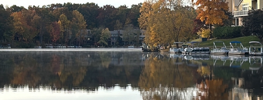
Feature photo: A Calm Day on Lake Audubon.  But Thermodynamics still governs geochemistry in lakes such as the status of chemical reactions, temperature, pressure, pH, mineral precipitation/dissolution, and gas exchange.

Article and photos by FMN Stephen Tzikas

An understanding of thermodynamics as it relates to lakes and streams is an important concept for master naturalists.

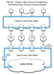
Illustration: https://hickoryclusterassociation.blogspot.com/p/relac.html

In a beneficial role, thermodynamics can cause the layering of lakes creating an opportunity for air conditioning.  The Reston Lake Anne Air Conditioning Corporation (RELAC) made use of this to provide green energy for residents from 1965 to 2025, before ceasing operations. The RELAC used a chilled water loop to provide cooling to building clusters in the Lake Anne area. The process involved a small central plant that cooled and distributed the chilled water.  The Carrier Air Conditioning Co., introduced the concept at the 1939-40 World’s Fair. Heat picked up by the water in cooling household air was removed by water pumped from nearby Lake Anne. The heated water was pumped back to Lake Anne.  The lake, 30-acres in size, was large enough to absorb the heat without significant temperature change.

However, there is a negative side to thermodynamic layering in lakes.  In the summer, lakes can have harmful algal blooms (HABs), lasting from days to months. After a bloom dies, the microbes that decompose the dead algae consume and deplete oxygen, generating a “dead zone” which can kill fish. The hypolimnion is the dense, cold, and deep bottom water layer of a thermally stratified lake, located below the warmer, well mixed surface-level epilimnion. Isolated from atmospheric oxygen, these summer oxygen depleted (anoxic) “dead zones” can persist until fall turnover.  The metalimnion, or thermocline, is the middle, transitional layer. It is characterized by a steep temperature decline, of about 10 °C.  As surface water warms in the sunlight, it becomes favorable to cyanobacteria growth. The lack of mixing causes deep-water oxygen to be depleted by bacteria decomposing organic matter. This anoxic condition breaks down sediments, releasing phosphorus into the water, which serves as fertilizer for blooms. These HABs also create toxins impacting water quality.

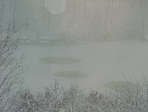
Ice circles on Lake Audubon (2/06/2010)

Moreover, thermodynamics can offer some rare, interesting phenomena. I live on Lake Audubon in Reston. In winter there is a phenomenon of ice circles. Ice circles are natural phenomena where circular slabs of ice rotate in slow-moving water, often found in lakes and rivers. They form when ice fragments in an eddy current, causing the ice to spin and be “lathed” into a circle by colliding with surrounding ice.  In addition, the ice doesn’t melt uniformly. Impurities, air under the ice, hotspots and snow cover will affect how quickly it melts. If there’s less snow in an area, it will have less reflective surface than something completely covered in snow.  It will therefore absorb more heat and melt faster.  The ice could be so thin that it looks like water.

Finally, with climate change, thermodynamics plays a favorable role via tree canopies.  Tree canopies regulate urban thermodynamics by cooling air temperatures up to 4–5°C through shading and evapotranspiration. A canopy cover of about 30% to 40% is most effective for mitigating urban heat island effects. Trees release water vapor through stomata. This conversion of liquid water to vapor consumes heat from the surrounding air.  Tree leaves intercept solar radiation, reducing the absorption of heat by asphalt and concrete surfaces, and limiting radiation re-emission. Stormwater thermodynamics can be affected by climate change too.  Thermal pollution caused by heated urban runoff can lead to thermal stratification in lakes, causing HABs.  Stormwater runoff also collects and transports nutrient pollutants, such as nitrogen and phosphorus, from lawns, farms, and impervious surfaces, adding to the problem.

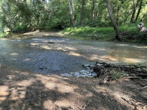
At a macroinvertebrate stream monitoring event, the tree canopy shading percent is recorded. This is estimated by considering the shade from streamside trees, shrubs, and grasses. Shading helps keep water cool and can be beneficial for aquatic life. In this photograph for Difficult Run site ID: DR34 (Leigh Mill Road, Great Falls, Difficult Run Stream Valley Park), on 7/20/2023 between 9-11:30 AM, the stream channel shade was estimated at 75% to full.


Your Yard Can Help Save Our Streams

Dense plantings of native plants capture stormwater

Article and photo by Plant NOVA Natives

Northern Virginia’s stream and river water quality is not great. Although agriculture is the largest contributor by far of nutrient and sediment loads in Virginia’s streams, rivers, and the Chesapeake Bay,  urban and suburban stormwater runoff is the second largest and the fastest growing contributor to these pollutants.

Consider, for example, the 52 square mile Accotink Creek watershed in Fairfax. For several years, the U. S. Geological Survey (USGS) and Fairfax County have partnered to monitor pollutants in 20 watersheds across the County, including Accotink Creek. The good news is that nitrogen levels have generally dropped. But phosphorus concentrations have remained exceptionally high. Why? Because 87% of the Accotink Creek watershed is developed with 27% of the land covered in impervious surfaces. Such intensely developed regions produce large loads of sediment from stormwater runoff, and phosphorus is bound to sediment. Reduce the sediment levels in our local streams, and you will lessen the phosphorus pollution.
Both the Virginia Department of Conservation and Recreation (DCR) and the Virginia Department of Environmental Quality (DEQ) have announced focused efforts during 2026 to reduce nutrient-based pollutants and sediment loads in our water. By December of 2025 we had met 100% of our sediment reduction targets, which is excellent news. But we met only 80% of the nitrogen and 62% of the phosphorus reduction goals.

This is a compelling call to action for all property owners in the Plant NOVA Natives community. Here are several strategies to reduce nutrient pollution and sediment loads in our waterways:

·   Plant more native plants, especially where stormwater tends to flow. Their deep roots stabilize the soil and absorb far more harmful nutrients than turfgrass lawns. Notice where stormwater tends to flow on your property along swales or slopes and plant there first.

·    Plant a street-side garden. Remember the underused strips of your property next to the street or sidewalk. These are ideal spots to add native plants, as their roots will catch stormwater overflow before it hits the pavement. Take care, however, to avoid underground lines, pipes, and overhead wires. And please consider whether your plantings impact people’s access to their cars, mailboxes, or safe crossing to the sidewalk. See Plant NOVA Natives’ comprehensive list of considerations for street-side gardens before you begin to dig.

·    Use organic compost. Ditching commercial fertilizers and using organic compost is always the best option to enrich the soil. But if you must use fertilizers, choose only phosphorus free or low-phosphorus brands and use them sparingly. 

·     Pick up pet waste: Nitrogen, phosphorus, bacteria like E. coli and Salmonella, parasites, and ammonia can all be found in pet waste! While pet owners often remember to pick up pet waste in public areas, remember to do so on your own property as well for the sake of our streams and rivers.

·    Compost and mulch yard waste: Composting and mulching are two strategies that effectively return nutrients to the soil and keep them out of stormwater. Grass clippings should be composted or mulched back into the lawn. Leaves are best left in non-lawn areas, but those that fall on the lawn can also be mulched or raked up and added to your compost pile. Keep lawn debris out of the street and away from storm drains.

·    Create a rain garden: Rain gardens are landscaped areas constructed to capture and hold stormwater so that it seeps into the soil instead of running off our property. A link to a step by step guide on how to build a rain garden can be found here on the Plant NOVA Natives website.

·    Use rain barrels: If you can capture water from downspouts and use it later to water your plants, this greatly reduces stormwater runoff caused by our roofs. 

·     Redirect downspouts to vegetated areas rather than paved impervious surfaces: When rain barrels are not an option, try to redirect downspout water flow away from sidewalks and driveways and towards the more vegetated areas of your property. 

·    Reduce impervious surfaces: Replacing asphalt with gravel or permeable pavers will capture and keep more stormwater on your property. But reducing the lawn by converting parts of it to native plant gardens is also highly effective. Turf grass, while green, behaves more like concrete when it comes to water absorption.

·    Maintain septic systems: Regularly inspect and pump septic systems to prevent nutrient leaching into groundwater.

·    Wash cars responsibly: Either use a commercial car wash or wash your car on grass to filter soapy water before it enters the ground.

Additional strategies to capture stormwater are discussed here on the Plant NOVA Natives website, along with a discussion of planting and maintaining riparian borders. Finally, here is a link to a Fairfax County Soil and Water Conservation District manual with instructions on how to build and maintain rainwater gardens, green roofs, and more.  


Paleontology on the Trail

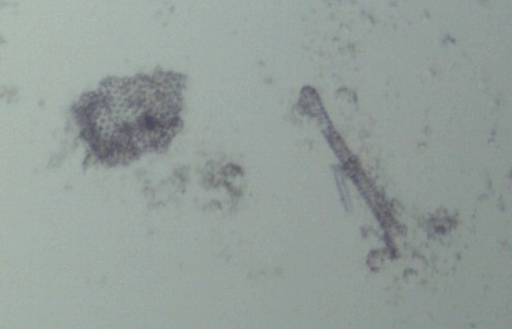
Diatom microfossil fragments at Brownies Beach, Maryland, magnified under the author’s microscope (Bausch and Lomb Stereo Zoom Microscope DD740). Diatoms are unicellular organisms and can be in various shapes.

Article and photos by FMN Stephen Tzikas

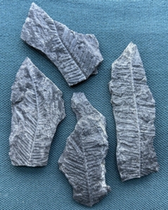
Anthracite fern fossils from Minersville, PA, commonly found in discarded coal piles in Schuylkill county, PA.

Fossils can be found on many trails.  I have collected them from coal deposits in Schuylkill County, PA, in the Calvert Cliffs, Maryland area as part of a Northern Virginia Community College (NVCC) course, and here in Fairfax County at Holmes Run Gorge.  The excursion to Holmes Run Gorge was also a NVCC geology field trip.  For the latter, upon reaching the main gorge area, we encountered fine examples of boulders of bedrock that were piled.

The larger, lighter gray, rounded boulders are mostly Occoquan granite. The flatter layered slab-like boulders with square corners are Indian Run rock of metamorphosed sandstone. In the main gorge area we discussed quartz rocks. Quartz is the last mineral in the Bowen reaction series, which is a geological concept detailing the specific order in which minerals crystallize from cooling magma. I collected a sample of cloudy white milky quartz, which is extremely resistant to weathering. The cloudiness of milky quartz comes from microscopic inclusions of fluids that have been encased in the crystal from the time the crystal first grew.

Our NVCC professor showed multiple examples of Quartzite with “slashes” (see photograph below).

Skolithos Linearis fossils at Holmes Run Gorge

High-energy waters transported these cobblestone size rocks originating from the Harper’s Ferry Antietam Formation. This Quartzite was originally Quartz sandstone that underwent metamorphic changes. Most noteworthy were the Tubeworm line boroughs (the “slashes”), about a half billion years old. Samples were numerous and I took one with a dark patch, probably of magnesium oxide on it.

The fossil in the Holmes Run Gorge photograph is the Skolithos Linearis in well-cemented quartzite of the early Antietam Formation, found in Pennsylvania, Maryland, and West Virginia. The formation is largely quartz sandstone with some quartzite and quartz schist. Quartzite is a hard, non-foliated metamorphic rock that was originally pure quartz sandstone. Sandstone is converted into quartzite through heating and pressure usually related to tectonic compression within orogenic belts. These are Virginia’s oldest fossils and date to the Cambrian Period. Skolithos is a common trace fossil ichnogenus that is, or was originally, an approximately vertical cylindrical burrow. It was produced by a variety of organisms in shallow marine environments and appear as lineated features in sedimentary rocks.

George Mason’s Virginia Climate Center Releases First-ever Statewide Climate Assessment

Cover of the First Virginia Climate Assessment, Virginia Climate CenterGeorge Mason University

George Mason University’s Virginia Climate Center (VCC) has unveiled the commonwealth’s first comprehensive, peer-reviewed climate assessment—a landmark report that provides science-based insights into Virginia’s changing climate and its impacts on communities, infrastructure, and the economy. 

This report marks the inaugural comprehensive assessment of climate conditions across the Commonwealth of Virginia. While Virginia’s diverse weather and climate patterns have been examined in both local and broader national and global contexts, no prior effort has synthesized the wealth of scholarly research specific to Virginia into a unified resource.

The Virginia Climate Assessment provides a science-based evaluation of the ways past, current, and anticipated climates have and will impact Virginia and its people. As the first report of its kind for the state, it provides a collection of evidence-based key messages that have been prepared and extensively reviewed
by technical and scientific experts across Virginia and beyond. It is expected to be the first in a series of such assessments, establishing a baseline against which future changes and impacts can be measured and understood, and adaptation effectiveness and resilience can be evaluated.

READ THE FULL REPORT

An executive summary for busy readers and the VCA’s top findings.

KEY MESSAGES

1. Virginia’s climate is shaped by weather patterns stemming from higher and lower latitudes, while regional variation reflects topography and coastal
proximity (high confidence).

2.The Virginia climate has become warmer (very high confidence) and wetter (medium confidence) in recent decades, with greater precipitation extremes
(high confidence) and more frequent tidal flooding (very high confidence) along the Atlantic coast.

3.Climate projections indicate continued warming (very high confidence) and wetting (medium confidence) for Virginia through the middle to late 21st century, with chronic tidal flooding along the Atlantic coast (very high confidence).

The Virginia Climate Assessment is intended to be used to inform climate adaptation plans, resilience strategies, and policy decisions, and provide evidence for developing targeted responses to climate impacts. Key Messages can be used to identify areas of critical need for strategic planning, provide supporting evidence for budget proposals, and outline potential directions for policy development or climate action planning.

DWR Asking Public to Report After Increase in Suspected Cases of Avian Influenza

Photo: Joe Subolefsky – Black Vultures./Audubon Photography Awards

PRESS RELEASE: RICHMOND, VA

The Virginia Department of Wildlife Resources (DWR) has recently received reports of groups of dead black vultures across the state including several counties in Southwest Virginia. Preliminary testing indicates that the likely cause is H5N1 highly pathogenic avian influenza (HPAI). Although disease activity is currently centered in black vultures, with migration season beginning, it is likely there will be mortalities in other bird species as well.

DWR asks that if you observe any of the following, please notify the Department by calling the Virginia Wildlife Conflict Helpline at 1-855-571-9003 or emailing wildlifehealth@dwr.virginia.gov.

  • �� Five or more dead vultures, waterfowl, shorebirds, or seabirds in the same area within five days
  • �� Sick or dead eagles, hawks, owls, or turkeys, excluding ones found on the road
  • �� Ten or more dead wild birds of any species in the same area within five days

The public is advised to avoid picking up or handling sick or dead wild birds. If you must dispose of a dead bird on your property, wear rubber gloves and other personal protective equipment, such as a mask and eye protection. Dead birds should be buried or double bagged and disposed of in a secured outdoor trash can or landfill. After disposing of the carcass, wash hands thoroughly with soap and water or use an alcohol-based hand sanitizer, and disinfect clothing, and shoes. If you are frequently in contact with poultry, including backyard flocks, or other domesticated birds, you are encouraged to have separate clothing and shoes for use in the areas where you keep those birds. In addition, keep flocks away from vultures and ponds or similar bodies of water that are also accessible to wild waterfowl. Taking these precautions will help reduce the risk of spreading the virus.

If you develop any flu-like symptoms after handling wild birds (fever, body aches, red or itchy eyes, etc.), contact your state or local health department.

More information on Avian Influenza can be found on the Virginia DWR website.

Article Review: “Ospreys May Be in Trouble Again”, Article by Glenda C. Booth

Photo: By Glenda Booth, Osprey and their young at the Belle Haven Marina platform nest on June 18, 2025. 

This complete article by Glenda C. Booth appeared in the July 17th edition of the Alexandria Gazette Packet:                       https://www.alexandriagazette.com/news/2025/jul/17/ospreys-may-be-in-trouble-again/

Glenda C. Booth’s article, “Ospreys in Northern Virginia,” is a well-crafted and engaging piece that combines local wildlife reporting with broader environmental concerns. Ms. Booth effectively relates scientific insights and on-the-ground observations from concerned community members to illustrate the troubling decline in osprey populations across Northern Virginia.  She describes the breeding observations at nesting sites like Dyke Marsh and Porto Vecchio. She also mentions potential stressors to breeding success —such as fish shortages, climate change, habitat loss, and commercial menhaden harvesting. The article makes complex ecological issues understandable. Ms. Booth’s article is informative and timely. It surely raises awareness about the challenges ospreys face and the broader environmental implications behind their struggles.

Article Review: “For the First Time in Decades, Hikers Can Walk in Forests of Mature, Wild American Chestnuts” Article by By Eric Wallace


Eric Wallace’s Article: “For the First Time in Decades, Hikers Can Walk in Forests of Mature, Wild American Chestnuts”, published in the July 24, 2025, Garden & Gun: Article Link

Eric Wallace’s article is a well-written and inspiring piece that effectively highlights a significant ecological achievement—the partial restoration of the American chestnut. It balances historical context, scientific detail, and emotional appeal.

For the first time in nearly a century, hikers can once again walk through mature forests of wild American chestnut trees, thanks to long-term conservation efforts. Once known as the “redwood of the East,” the American chestnut dominated forests from Mississippi to Maine, offering durable wood and abundant nuts. However, a devastating fungal blight introduced in the early 1900s wiped out nearly all mature trees within a few decades, rendering the species functionally extinct.

In response, the American Chestnut Foundation (ACF) and its partners spent decades developing blight-resistant hybrids by crossbreeding American chestnuts with Asian varieties and then backcrossing to retain the original tree’s genetics. These efforts are now bearing fruit—literally and figuratively—with sites like Lesesne State Forest in Virginia hosting 60-year-old, 70-foot-tall chestnut trees that are once again producing nuts.

Today, visitors can hike through several restored chestnut groves across Virginia, including Matthews State Forest, Sky Meadows State Park, and Mountain Lake Wilderness. The trails range from two to four miles and offer a rare opportunity to witness the rebirth of a species that once seemed lost. This resurgence of the American chestnut is more than a conservation victory—it’s a hopeful sign that damaged ecosystems can be healed with persistence and science.

Article Review, “Dyke Marsh: A Fragile Treasure” by Glenda C. Booth, President, Friends of Dyke Marsh

Photo by Ned Stone, A Dyke Marsh inlet.

Article: “Dyke Marsh: A Fragile Treasure”, published in the July 14, 2025, Northern Virginia Bird Alliance News:  https://www.nvbirdalliance.org/news/dyke-marsh-a-fragile-treasure

Glenda Booth’s article presents a thorough overview of Dyke Marsh’s ecological importance, biodiversity, history of degradation, and current restoration efforts.

Dyke Marsh, part of the George Washington Memorial Parkway and overseen by the NPS, is one of the largest tidal freshwater marshes remaining in the Washington, D.C. area—some parts are over 2,200 years old. It is a vital habitat supporting over 230 bird species and a rich variety of plants and wildlife. This area delivers vital ecological services such as flood mitigation, water purification, and biodiversity support.

Once damaged by decades of dredging, it has faced severe erosion, invasive species, and pollution. Restoration efforts, including a breakwater and shoreline stabilization, aim to reverse the damage. The Friends of Dyke Marsh (FODM) actively support conservation through invasive species removal, wildlife monitoring, and public education. Despite its fragility, Dyke Marsh remains a valuable natural refuge for both wildlife and visitors.

Dyke Marsh stands as a rare and vital natural habitat in the D.C. region—rich in biodiversity and ecological function, yet under serious threat from past dredging, ongoing erosion, invasive species, and human disturbance. Thanks to significant funding, restoration actions, and volunteer efforts by FODM, there is hope for its recovery and continued benefit for wildlife and people.