Geology On the Trail
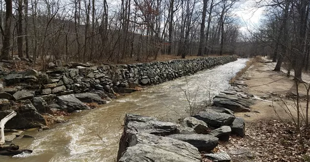
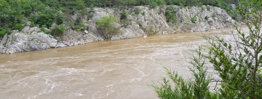
Feature photo by author; Mather Gorge.This gorge runs downriver from Great Falls. Steep walls funnel the Potomac River down to a narrow width. The relatively straight shape may be due to the Potomac following a fault line (fracture) and caused by progressive erosion as the falls dug backwards.
Article by FMN Stephen Tzikas
Geology is an inherent part of all trails. Some trails may have unique geological features. However, all trails in Fairfax County and Northern Virginia share a similar geological history. Virginia’s geology is that of orogeny, or mountain building, in more common terms. Virginia’s orogeny followed cycles. The Grenville Orogeny marked the amalgamation of the supercontinent Rodinia, about 1.3 to 1.1 billion years ago. Rodinia’s rifting (i.e., breakup) began about 1 billion years ago. So began a cycle, called the Wilson Cycle. The Wilson Cycle, or the cyclical opening and closing of ocean basins, can be explored at Great Falls Park.
After the Grenville Orogeny, there were three others. The Taconic Orogeny commenced about 470 million years ago. This
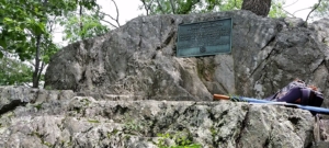
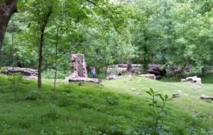
Photo by author; Rock with Washington Plaque
orogeny involved volcanic island chains in the Iapetus Ocean, as the ocean next to Virginia was then called. At about 420 million years ago, the Iapetus Ocean had completely closed and the combined mass of land formed the new continent of Laurasia. This was followed by the Acadian Orogeny about 390 to 360 million years ago. This orogeny involved a collision of Avalon with eastern North America. Finally, the Alleghenian Orogeny occurred about 300 to 250 million years ago. This orogeny resulted from a collision between North America and Africa. This orogeny was a continent-continent collision that formed the supercontinent Pangea. Following the Alleghenian Orogeny, the supercontinent of Pangea eventually rifted and the Atlantic Ocean was created. Why did it start with Grenville and not before? Well, Earth up until then was a very active place with the process of plate tectonics and continental landmasses still in development.
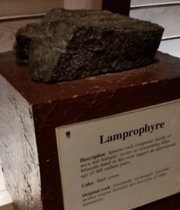
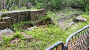
Photo by author; Lamprophyre at the Great Falls Park Museum, formed during the Acadian Orogeny
At Great Falls Park one can find evidence for the deposition of turbidites from the Grenville Mountains into the Iapetus Ocean. Turbidites are underwater avalanches which slide down the steep slopes of the continental shelf edge. These turbidite deposits underwent metamorphism and up thrusting into the rocks of Great Falls Park. At one of the park’s landmarks, a rock with a George Washington memorial plaque is found. This rock has alternating layers of metamorphic mica schist and metamorphic metagraywacke turbidite deposit. More precisely, these were formed when sedimentary layers became destabilized and fell from the slopes of the continental shelf into deep ocean waters. These sediments were transported and deposited by density flow, not by tractional or frictional flow. That is, the coarser material settled first, the finer particulate matter followed.
Not as old as the turbidites, Granite too was push up unto the continent during the
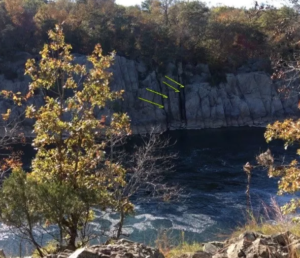
Photo: Nanette Nyce, NPS website; Lamprophyre dikes in Mather Gorge. Yellow arrows point to dikes.
Taconic Orogeny. In further orogeny events, the area of Great Falls was active with volcanoes. About 360 million years ago Lamprophyre intruded into the fractures and dykes of older formations. The Lamprophyre rock was a volcanic igneous mica and feldspar and cooled upon reaching the surface. Many of these rock types are on display at the Great Falls Park museum. The Lamprophyre Dikes can be seen near the head of Mather Gorge, just south of Rocky Islands. They are a striking series of dark, vertical lines visible on both sides of the Potomac River.
When the last rifting occurred about 200 million years ago, faulting occurred as well as jointing. The latter are fractures in rock, unlike a fault, which involves displacement. Joints can form due to cooling, shrinkage, or tectonic forces. Jointing too can be as seen at Great Falls Park. During this last phase rivers started flowing eastward again, sediments started flowing into the Atlantic, and the Potomac River may have started forming. About 3 million years ago the Ice Age began, and ice as high as 2 miles would cover NYC and Chicago. About 20,000 years ago, the ice age started thawing. While the Potomac was flowing during the ice age, its flow would begin to slow as its gradient would decrease as sea levels rose and further erosion of the Appalachian Mountains occurred.