What’s For Dinner? Reconnecting Our Food With Our Climate

Photo: SERC

Tuesday, October 24, 2023
7 pm
Zoom, hosted by Smithsonian Environmental Research Center (SERC)
Register here.

Our food systems have become increasingly fragile in the face of climate change, ongoing conflicts and the long-tail of the COVID-19 pandemic. More frequent—and more intense—extreme events challenge food production, storage and transportation. At the same time, how we grow, process, package and transport our food often harms the environment, further accelerating climate change and biodiversity loss. Fixing this requires bridging the gap between food policies and climate policies. Join Dr. Jessica Fanzo for a look at sustainable food practices for a hotter, more turbulent world. Fanzo directs the Food for Humanity Initiative at the Columbia University Climate School. In this talk, she’ll reveal the must-do actions to nourish 9.7 billion people by 2050.

The Mysterious Migrations of Cownose Rays, webinar September 19th

Photo: SERC

Tuesday, September 19, 2023
7 pm
Zoom, hosted by SERC

Register here.

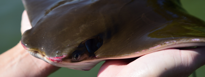
Cownose rays are enigmatic, and sometimes controversial, summertime inhabitants of Chesapeake Bay. Smithsonian Environmental Research Center’s Fisheries Conservation Lab has been tagging cownose rays and tracking their long-distance migrations since 2014. On Sept. 19 Dr. Matt Ogburn, head of the Fisheries Conservation Lab, will reveal some of the discoveries from this 9-year tracking effort. Their studies have uncovered the rays’ overwintering habitat, documented the different migration patterns of males and females, and revealed the environmental cues that help rays know when to start migrating. These findings are helping support conservation and management of this often misunderstood and overlooked stingray.

This webinar will be recorded! Closed captioning will be available during the live event and on the recording. By signing up on Zoom, you’ll be able to join live and receive a link to the recording approximately one week after it airs.

National Public Lands Day, September 23rd

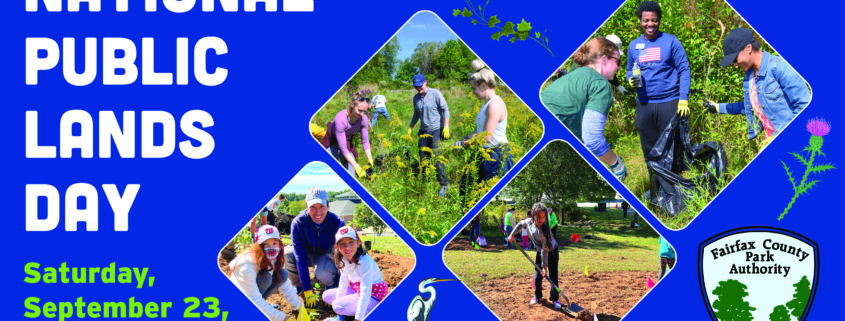
For 30 years, National Public Lands Day has mobilized volunteers of all ages to engage in a celebration of service and stewardship of America’s public lands. The event is the largest single-day national volunteer effort to preserve, restore, improve and enjoy America’s public lands.

Fairfax County Park Authority invites you to be a part of their celebration of National Public Lands Day by taking part in any of a wide selection of service activities to protect the natural, cultural and recreational resources of our treasured park system!

Check out their list of service opportunities by location that day.

Science in Your Watershed

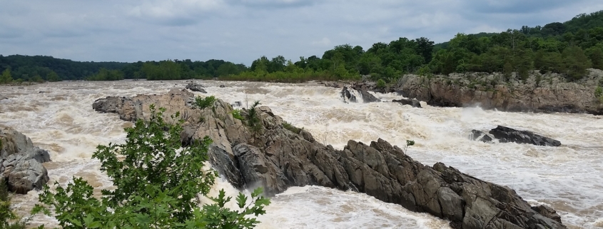
Feature photo: The Mighty Potomac on June 2, 2018

Article, photo and images provided by FMN Stephen Tzikas

A watershed is a common geographic area that drains all streams and rivers into a common outlet, like a bay.  The Northern Virginia Soil and Water Conservation District has a macroinvertebrate stream monitoring program that helps protect our watersheds:

https://www.fairfaxcounty.gov/soil-water-conservation/volunteer-stream-monitoring

Getting to know your watershed is like getting to know your neighborhood.  Our local Potomac Watershed is part of the Chesapeake Watershed, which is part of the Mid-Atlantic Watershed, and which is part of the Eastern Watershed.  A principal river of a basin is a river that drains directly into the ocean.  Our Atlantic Seaboard Basin includes the Hudson River, Delaware River, Susquehanna River, our local Potomac River, and the Savannah River.  Your watershed’s information can be found at this USGS website which contains many USGS links:

https://water.usgs.gov/wsc/map_index.html

You can visit the Environmental Protection Agency (EPA) website, type in your zip code, and get a local map of your watershed: https://www.epa.gov/waterdata/hows-my-waterwayFor example, my Reston home location is part of the local Difficult Run watershed.
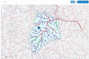
Illustration by author:  Local Watershed Generated by the EPA website per input of the 20191 zip code. Notice the drainage pattern. Depending on a location’s geology, drainage patterns can be dendritic, trellis-like, rectangular, or radial.

The website provides physical, chemical and biological water quality factors from its monitoring locations.  In Fairfax County, drinking water comes from two major sources: the Occoquan Reservoir and Potomac River.  Fairfax Water operates both the Corbalis and Griffith treatment plants, where water undergoes a series of treatments.  In recent years, new emerging contaminants have become a concern in drinking water. You can help protect the drinking water quality in Fairfax County by preventing water pollution and reducing runoff.  For example, don’t flush expired pharmaceuticals in the toilet, and keep car wash suds out of the storm drains.

By visiting the USGS water data website, more interesting data can be gleaned: https://waterdata.usgs.gov. I used this site to compare historical information to an unusually high level of water in the Potomac River following a large rain event.  The unusual event took place on June 2, 2018, the day I took a geological excursion to Great Falls Park with Northern Virginia Community College (NVCC).

The flux of the Potomac River on June 2, 2018 was 25,000 cubic feet per second as recorded at Little Falls dam and pumping station. River flux is controlled both by precipitation and the size of the watershed. Flux affects erosion rates. When a path of a river narrows the velocity rises, and there is more erosion by 3 types of stream loads. Dissolved load is comprised of invisible minerals carried to the ocean, where through evaporation and concentration, the ocean receives its high salt content. The suspended load carries the coarser sands and requires a faster velocity.  The competence of a river is the maximum particle size that it can transport, and the thalweg is the line of lowest elevation within a watercourse. As one walks toward a thalweg, the brushing of sand particles upon the leg will be stronger. The bed load rolls along a river bottom, and these carry the largest and heaviest materials. The Appalachian Mountains feed these three loads through erosion.

The mountains now average about 3,500 feet in height, but were up to 20,000 feet at peak height some 200-300+ million years (Myr) ago. These higher mountains had a steeper gradient 100 Myr ago. The velocity was higher, as well as cut down, and so too the erosion. As a river cuts down, mass wasting can fill in through rock falls on the sides. In 100 Myr the Potomac River will be flatter and wider with a lower gradient. This is compounded by rising sea levels by melting polar region ice.  During the entire time of our NVCC geologic hike through Great Falls Park we did not change elevation.  But there was a cut down from upstream (where we stood on the shoreline) to downstream of the river (where it was a gorge). Another type of river dynamic is headward erosion. Downstream waterfalls push rocks off causing the waterfall to slowly move upstream. In floods the competency goes down and larger particles settle as the river covers a wider area.
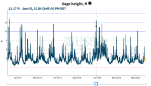
Pro Illustration extracted by author:  Gage Height Potomac on June 2, 2018.  This illustration shows the gage height during the heavy water flows on June 2, 2018. Date marked by blue square.

Also visit the National Water Dashboard link at https://waterdata.usgs.gov and go to Potomac River near Washington, DC Little

Falls Pump Station, by zooming in on the map.  Select that pump station and click the site page link on that new page.  Find the legacy real-time page link and select it.  At this link location one can search on specific parameters, such as gage height, for a date rage.  Gage height is the height of the water in the stream above a reference point. Notice how large Gage Height was on June 2, 2018 during my geological excursion.

2022 Report Updates Status of Reston’s Environmental Attributes

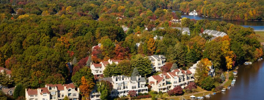
Photo: Provided by Northern Virginia Aerials, Reston

Article provided by Master Gardener intern/Master Naturalist Robin Duska

Ever wonder about how to measure the effects of development on the environment?
In 2017, Reston’s Environmental Advisory Committee set out to establish one approach: A baseline against which the desirability and effect of changes resulting from development or other causes could be assessed. Today, as Reston, like much of Fairfax County, accommodates ever higher population densities, it strives to maintain elements of its natural areas, water features, woodlands, and open spaces that give its residents a sense of well-being, benefit the economy, and provide a host of critically important ecological services.

The 2022 Reston Association State of the Environment Report (RASER) addresses 23 specific natural resources or environmental topics, to include many that may be of particular interest to Master Naturalists such as Streams, Stormwater, Urban Forests, Landscaping & Urban Agriculture, Birds, Wildlife Management Issues, and Light Pollution. Although Reston-focused, many of the data apply more generally to Fairfax County.

For each topic, Background information on the subject is provided, followed by a description of Existing Conditions in Reston. Conclusions are then drawn using colored traffic light icons to indicate whether the overall condition of the topic is considered good (green), fair (yellow), poor (red), or undetermined (black). RASER’s separate 2022 Report Card & Recommendations document provides a list of recommendations to better protect or improve upon Reston’s environmental conditions. It also annually
tracks the progress made on implementing previous RASER recommendations and is briefed each year to Reston’s Board of Directors. Given Reston is a census-designated area rather than a town, the Board is Reston’s decision-making body.

RASER is designed to complement the information Fairfax County’s Environmental Quality Advisory Council reports in its Annual Report on the Environment. Master Naturalists can access RASER here to read the lengthy full report, an executive summary of its conclusions, or individual chapters such as those listed above as well as the Report Card & Recommendations. Other Reston-produced environmental information is available here, including a 2021 report on best management practices for
invasive plants and Reston’s Biophilic Pledge.

The RASER project team co-led by Master Naturalist Doug Britt and Master Gardener intern/Master Naturalist Robin Duska, will welcome additional volunteers to produce the 2024 edition of RASER. Reston residents can also volunteer to serve on Reston’s Environmental Advisory Committee (EAC). To volunteer for either or both, please contact EAC’s Doug Britt at [email protected] or Surekha Sridhar at [email protected].


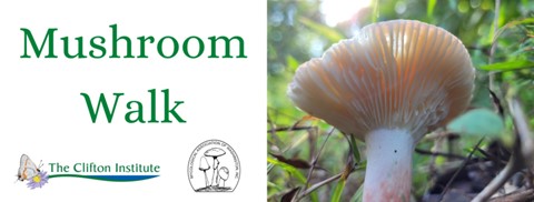
Image: Courtesy of The Clifton Institute

Mushroom Walk, October 14th

Saturday, October 14, 2023
2:00
– 4:00 PM

FREE

The Clifton Institute
6712 Blantyre Rd
Warrenton, VA 20187

Registration is REQUIRED.


Come to the Clifton Institute for a  fung-tastic afternoon with friends at the Mycological Association of Washington, DC to learn about mushrooms! This program will include a presentation on mushroom biology and identification followed by a walk where we’ll see how many species we can find.

Age: Adults and children accompanied by an adult.

Weather policy: Date and time subject to change dependent on weather. Please check your email for updates on the morning of the event.


The Corporate World Embraces Native Plants

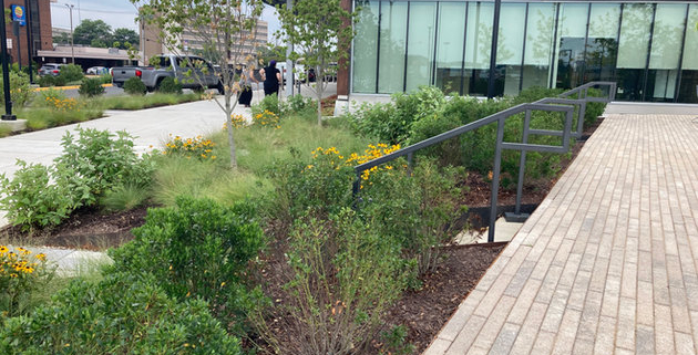
Article and photo by Plant NOVA Natives

Most corporate properties have pretty “standard” landscaping, meaning the plants do very little if anything to support the local ecosystem. More and more, though, we are seeing innovative landscape designs on commercial properties that demonstrate the potential for corporations to be leaders in the effort to save the natural world, starting on their own land. While they are at it, they are creating beautiful and welcoming spaces for their clients and employees.

One example of this approach is the work done at the recently-opened Kaiser Permanente medical centers in Springfield and Woodbridge (Caton Hill). Both properties are richly landscaped with trees, shrubs, grasses and perennials that are almost entirely native to Northern Virginia. (The few exceptions are non-invasive.)

According to Alton Millwood, director of Planning, Design and Construction at Kaiser Permanente Mid-Atlantic, “The landscape design at Caton Hill Medical Center focused on allowing the natural environment to be a part of the community’s wellness plan. There is an abundance of research showing that exposure to nature can lower our heart rate, alleviate mental distress, speed recovery rates, and even alleviate symptoms of mental disorders. This is why Kaiser Permanente felt it was important to keep natural woodland areas on the project site and invite people into those space with trails and areas to sit and relax. Additionally, the native plants used on the site help to create a healthier environment by providing food and habitat for birds and other wildlife, conserving water, and reducing noise and pollution associated with mowing. It only made sense that if we were going to involve the natural environment for our own health that we would do what we could to improve the health of the environment.”

Another goal of the project was to help Northern Virginia region meet its stormwater goals to protect the local streams and the Chesapeake Bay. The planting beds and the rooftop meadow decrease the amount of runoff from impervious surfaces. Design considerations included using a variety of native plant species to provide four-season interest, using low-maintenance plants that will not require long-term watering, and choosing species that will grow to the appropriate size for their locations so that important sight lines remain open and safe.

The reaction of employees and patients alike has been extremely positive. “Many members and staff have taken advantage of the outside seating, walked through the Gardens and Health Park to immerse themselves in nature and its healing benefits, and observed the rooftop meadow flowers in full bloom, with birds and pollinators busy in their tasks.”

Asked what would be his advice to other corporations, Alton replied, “Using sustainable design practices such as planting native plants is good for people and the environment – it is a win-win. For corporations, sustainable design can impact their bottom line, too. Native plants are more likely to live long and thrive in our environment. They require less maintenance, less fertilizer and pesticides, and less water. All this adds up to savings for the owner. Hiring a like-minded design professionals can help you create places like Caton Hill Medical Center that help benefit our community and the local ecosystem.”

More photos of this and other corporate or small business landscaping projects can be found on the Commercial Landscaping page on the Plant NOVA Natives website.