Biodiversity or Mosquito Fogging: You can’t have both

Article and photo by Plant NOVA Natives

Ah, the mosquito. It plagues our summers and can ruin our outdoor fun. Is anyone a fan? If so, consider the Asian tiger mosquito, which has no regard for personal space or time. If you happen to have it in your yard, it bites everyone, morning, noon, and night. In winter we long for warm weather, but when it finally arrives, in some neighborhoods we are indoor prisoners. Understandably we want to rid ourselves of this awful pest.

Some of our neighbors turn to commercial-grade mosquito fogging, persuaded by marketing claims that the product is both effective and “safe”. But a closer examination of these claims reveals an ineffective process that is devastating for native bees, butterflies, moths, and a plethora of other beneficial insects we work so hard to attract with native plants.

How effective is mosquito spraying? How effective can it be when the chemicals in the product only target adult mosquitos and only those adults within direct range of the fog? By some estimates, no more than 20-30% of adult mosquitos are killed in one treatment. Meanwhile all mosquito larvae, which are laid and hatched in standing water, are unaffected. They continue to grow and emerge as if nothing harmful has happened in their environment. As a result, the adult population of mosquitos is quickly replenished while nearly every other insect the fog touches is indiscriminately killed.

Mosquito spray producers point to EPA statements that the chemicals are safe for bees when used according to label instructions. But there are severe limitations to the EPA’s testing method. The agency only tests on honeybees and only measures the chemical toxicity resulting from surface exposure, not oral ingestion.

This is highly problematic. Honeybees are only one species of bees and are non-native to boot. That leaves 400 species of native bees in Virginia, along with all butterflies, moths, dragonflies, ladybugs, fireflies, and numerous other beneficial insects that are not tested. Those insects have entirely different life cycles, foraging methods, and ways of protecting and feeding their larvae which render them tragically vulnerable. It is a complete folly to extrapolate EPA’s honeybee-focused test results to any other insect species.

Consider this: One spray of mosquito fog leaves a persistent residue on the surface of everything it touches. Repeating the applications every 10-30 days, as many commercial services recommend, just compounds the problem. The EPA says it considers how long the chemical residue persists in the environment and its effect on honeybee colonies. However, honeybees can forage up to 5 miles away from their hives if necessary, far away from the fogged area and the residue. Our native mason bees, on the other hand, forage no further than 300 feet from their nests. They are wholly dependent on the health of their immediate surroundings to eat and reproduce. Adults have no way to avoid exposure.

Neither do their larvae. Leaf cutter bees and mason bees, for example, produce dough balls that are left in hollow stems for their developing larvae to eat. The balls are composed of pollen and nectar from the flowers in their immediate foraging range. As the larvae hatch and eat the dough balls, they ingest concentrated levels of the pesticides and die. For our native bees, there is no honeybee equivalent of the hive to ensure their survival. They live their lives alone. As their larvae die, all subsequent lines of offspring from affected individuals are gone for good.

Fortunately, as research has advanced on fogging, so too has the thinking on several alternative, inexpensive methods of control. Here are some very safe and effective suggestions, especially when used together as a suite of tools.

Source Removal. The most effective method of mosquito control by far is “source removal,” or emptying/eliminating all sources of standing water on your property. This practice kills mosquito larvae before they become biting adults. Regularly inspect your property for containers or areas that hold water, then remove or empty them. Remember to inspect flowerpots, buckets, or any other feature or item that can hold water. Change the water frequently in places where you want it – like birdbaths – so the larvae have no time to grow and emerge. Maintain your gutters and downspouts so the water flows. Keep your swimming pools and hot tubs clean and properly chlorinated.

Mosquito Buckets: This is a favored method of control by Doug Tallamy, an entomologist at the University of Delaware and national proponent of supporting biodiversity in our own backyards. He recommends filling a five-gallon bucket of water, placing it in the sun, then adding a handful of hay, grass, straw, or leaf litter to decay and attract egg-filled female mosquitos. After they lay their eggs, add a mosquito dunk tablet you can purchase at any hardware store, garden center, or home improvement retailer. It contains a bacteria that kills several species of fly larvae, including mosquitoes. A more detailed explanation of the process – and photos of lovely painted buckets –  can be found on Dr. Tallamy’s Homegrown National Park website.

Ovitraps: Ovitraps, which are available from the same stores as mosquito dunks as well as on Etsy, use scent to attract adult egg-laying females, trap them, and kill both the adults and the larvae they produce.   

Water Wrigglers: Water Wrigglers are devices you can purchase to keep water moving in birdbaths. They were designed to attract birds to the sight and sound of running water but are also highly effective in stopping female mosquitos from laying eggs.

Deck Fans: Mosquitos are weak fliers. Turn on a fan while you enjoy your deck and make it harder for mosquitos to reach you.

Personal Protection: When spending time outdoors, consider wearing long pants, sleeves, and a hat, and spraying your clothing and skin with insect repellant. Personal precautions such as these can prevent mosquito bites entirely.

Community Efforts: Mosquito control is very successful when several neighbors in a larger community participate. Talk to your neighbors about source removal, ovitraps, fans, and water wigglers. Show them your homemade mosquito bucket and encourage them to do the same – or bring them one as a gift! Some studies tout this approach above all others, suggesting that mosquito populations can be reduced by 85% when the whole street or block works together. One way to approach your neighbors is by inviting them to join a Pollinator Pathway and giving them a nifty little sign to display which will encourage other neighbors to rethink their mosquito-spraying contracts.

We all enjoy our yards and our pollinator gardens, and we understand how including native plants promotes biodiversity. But along with joy comes responsibility. If we don’t protect the very life we’ve helped emerge, no one will. We can have improved biodiversity, or we can have pesticides. They do not co-exist.


 

The Grist Mill at Colvin Run Mill Park

Feature photo: Fairfax County Park Authority

Article and other photos by FMN Stephen Tzikas

Just off Route 7 in Great Falls, Virginia, is a rare working grist mill from the early 19th century. The Colvin Run Mill campus is part of the Fairfax County Park Authority, and is an opportunity to see nature and engineering working together.  Grist mills offer the opportunity to observe engineering principles related to powder technology in a park setting.  In 2002, my first visit to a mill, known as Evins Mill, coincided with a chemical engineering course on powder processing I attended in Tennessee. The instructor wrote the Size Reduction and Size

Close up of the water wheel

Enlargement chapter in Perry’s Chemical Engineering Handbook. The simple grist mills of the past represented the beginnings of powder technology engineering. Powders are used in a variety of industries including the pharmaceutical, consumer products, food and industrial chemical sectors.  The handling of powders requires a knowledge of properties related to particle size, moisture sorption, surface area, surface chemistry, hardness, density, and flowability. Operations include segregation and powder sampling, as well as key unit operations of mixing, grinding, agglomeration, classification, fluidization, drying and compaction, as well as solids transport between unit operations.

The grinding unit

The Colvin Run Mill is powered by a 20-foot waterwheel. The use of elevators, moving belts, and Archimedean screw conveyors made the milling operation more efficient and profitable, as an early example of mass production. The wheel’s axle transmits power from the turning waterwheel into the mill. The greater face gear attached to the axle in the mill basement turns the wood gears that operate the grinding stones, grain elevators, and sifting machinery. The waterwheel produces up to 26 horsepower, turning (outside) at a rate of 10 rpm, resulting in a top grindstone rate of 100 rpm.  Premium burr stones were imported from France to grind the grain.

The tour of the mill’s four floors includes the main grinding floor, the

The racker unit, which cools the powder and prevents its caking

basement, the gear pit, and other processing units. The mill offers the ability to load, convey, sift, grind, separate and dry grain into various desired grades. Each of the four floors of the building served a specific function in turning the grain into flour or cornmeal.

The engineering processes seen at the Colvin Run Mill tour will include:

  • Gears: Falling water moves the water wheel and all gears throughout the mill’s operation. The speed of the water wheel can be adjusted, thereby controlling the speed of the
  • Lever: A beam scale weighs grain from farms. A receiving hopper gathers the grain.
  • Pulley: Pulleys move grain upstairs for cleaning. The grain flows down a chute where it is captured by cups, and transported to the top floor and emptied into another chute.
  • Screens: Screens remove dirt, seeds, sticks, straw, chaff, fungus, smut, broken grains, and bugs. Shaking shifts the grain.  There are different size mesh screens for final processing of the milled grain.  They range in size from super fine to coarse.
  • Inclined plane: A inclined plane sends the cleaned grain to the grinding operation.
  • Grinding: Special French millstones mill the wheat. A screw lifts the mill stone into place for grinding. Wedges line the millstone where they grind the grain. These special French millstones are fossils called burr stones. They rip and shred the grain.  Shafts in the stones move the grain to the next operation.
  • Raking:  Since crushing the wheat generates heat and warms the grain powder, rakes (known as hopper boys) help cool the wheat and prevent caking and clumping


Beech Leaf Disease (BLD)

Photo: Courtesy of FCPA, Beech Leaf Disease observed in Burke Lake Park

The following Information comes from the Urban Forest Management Division Annual Report Fiscal Year 2024, Released April 2025

Beech Leaf Disease (BLD)

What is it?
BLD, a relatively new disease of native American beech as well as other
Fagus/beech species, is caused by a foliar-feeding nematode (a
microscopic roundworm). The nematodes enter the tree’s leaf buds in
the fall where they overwinter, multiply, and feed on newly forming
leaf tissues. The nematodes further multiply and spread throughout
the tree from year to year until leaf buds no longer produce leaves.
As healthy foliage decreases, the tree’s energy, nutrient, and water
uptake decreases, and the tree eventually dies.
Why is it a problem?
Beech trees are critical to the native forest ecosystem, providing
food for a wide variety of wildlife, and bearing nutrient-rich fruit with
seeds that last through the winter and serve as a food source when
other plants have long stopped producing. There are approximately 4.3
million beech trees in Fairfax County, making them tied with red maple
for the County’s most common tree species. BLD, nearly 100% fatal,
is spreading rapidly; and there is no known safe treatment option for
forested environments.
What is being done?
County staff achieved the following results and milestones in FY 2024:
 Mapped 6 infestations totaling 60 acres at regional and County parks (previously 13 acres in FY 2023).
 Established 4 monitoring plots in beech stands confirmed to have, or at high risk of developing, BLD.
 Participated in a comprehensive U.S. Department of Agriculture (USDA) Forest Service study spanning the full geographic reach of
both BLD and beech bark disease.
 Hosted a webinar—“Unraveling the Mystery”—in partnership with Virginia Cooperative Extension (VCE) to raise awareness.
 Contributed BLD samples for a regional nematode DNA study out of the University of Connecticut.
How YOU can help!
– First, learn to IDENTIFY early symptoms of the disease, infected leaves, and other diseases that can appear like BLD.
– REPORT sightings on iNaturalist, an easy-to-use app that shares information with community scientists.
– And finally, PRACTICE good tree care such as proper mulching and watering during droughts; and be considerate and responsible when it
comes to selecting soil treatments and other landscaping services.

This report is in PDF format which allows you to search for other pest like the hemlock woolly adelgid, and the spotted lanternfly..


Pollinator Pathways: Connecting your yard to the bigger picture

Photo: Plant NOVA Natives

Article by Eileen Ellsworth

Imagine the world as it once was. Verdant forests, buzzing meadows, and numerous other natural areas were immense, whole, and pulsing with life. Over time, human activity emerged and carved the natural world into disconnected, even isolated parts. Ecologists refer to this process as habitat fragmentation. You can see it in urban settings where green parks are biological islands surrounded by buildings and concrete roads. You can see it in rural settings where agriculture simplifies ecosystems and amplifies the populations of only certain insects to the detriment of others. You can see it in suburban settings where developments destroy natural habitats and where landscapes are “replaced” with all non-native species.

Large and mostly undisturbed ecosystems can still be found, of course, especially in our beloved national parks and forests. But even they are distant from each other, understaffed, and too small in total acreage to sustain the biodiversity of the continent. Any solution to the problem of habitat fragmentation and the resulting loss of biodiversity, therefore, must be found right here among the throng of human life – where we live, work and play.

Is it possible to reconnect isolated fragments in our urban, suburban, and rural settings to benefit pollinators and the creatures that depend upon them? That was the question that sparked the “pollinator pathway” concept in 2007 by Sarah Bergmann, an artist living in Seattle. As part of a social and ecological project, she envisioned and described a network of native gardens that could create a “pathway” to support pollinators. This core idea led to the creation of a nonprofit – Pollinator Pathway – by Donna Merrill, a conservationist from Wilton, Connecticut, in 2017. Since then, the group has helped inspire and launch a national movement.

The idea is a powerful one. Anybody can take part, even at a novice level. There are very few barriers to participation. If all you have is one native tree or a  small pollinator garden – preferably one with some native plants – it’s a start, and you can build from there.

The main goal of a pollinator pathway is to reinstate connectivity between several small but healthy habitats. A single native tree can support bees and other pollinators as much if not more than a flower garden. Building a pollinator pathway on your street, for example, may include adding a new native tree or two, or creating new healthy gardens on communal grounds or private property as “stepping stones” along the way. It may include the expansion of existing native plant areas. Removal of invasives that disrupt the pathway will certainly be part of the plan, along with pledges to avoid all broadcast pesticides including mosquito and tick sprays. Only unpoisoned ecosystems can be included in the work.

Many communities across America are already building pollinator pathways and proving the concept. You can recruit participants on your own, or have fun working with like-minded people to muster engagement. Hold a kick-off meeting to build some early momentum. Don’t over plan. Take some early action, starting with 1 or 2 easy planting projects, then see where it takes you.

On a new webpage just launched by Plant NOVA Natives you will find some handy tools to help you build a pollinator pathway in your neighborhood or community. They include:

  • A tip sheet for pollinator pathway organizers
  • Instructions for ordering medallion signs that will be delivered to your house from Plant NOVA Natives for you and your participants. If you are in Northern Virginia, we will have the sign company mail you the first five for free.
  • Ideas for how to pitch the idea to the folks you want to engage
  • Pollinator Pathway handouts to leave with your neighbor.

Join the movement! Let’s work with our neighbors and friends to connect the fragments, rebuild some beneficial habitats, and heal the everyday ecosystems that surround us. Their resilience is astonishing. New life, activity, and hope will certainly emerge, along with a new joy in being part of something much bigger than our own backyards.

“Distillation” on the Trail

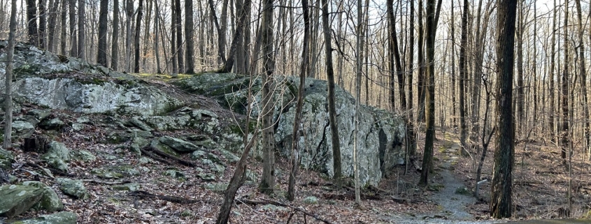
Charcoal Trail Greenstone Outcrop at Catoctin Mountain Park

Article, photos & illustration by FMN Stephen Tzikas

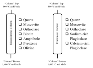
A few months ago, I prepared a roadside chemical engineering field trip to the Catoctin Iron Furnace in Maryland, for the local chapter of the American Institute of Chemical Engineers.  One of the features on that excursion was a discussion of nature’s “distillation column.” While chemical engineers study distillation at university, nature has its own type of “distillation column.”

The Bowen Reaction Series

Geologists call it the Bowen Reaction Series. The Bowen Reaction Series is a set of reactions that occur when molten igneous rock cools, usually on its way to the surface.  These reactions can be rather gradual (“continuous”) or abrupt (“discontinuous”). Virginia has many igneous rocks, often delivered to the surface as a consequence of past orogenies, or mountain building collisions with land masses off the East Coast, over the period of the last billion years.  Locally, one can find igneous rocks at Great Falls Park and its museum, as well as the outside massive rock collection surrounding the property of USGS in Reston.

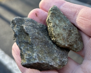
A little further west and north of Fairfax County is mountainous terrain.  One finds a lot of greenstone, such as the old greenstone lava flows of Shenandoah National Park, or those rocks of Catoctin Mountain Park. Greenstone, a term for dark green metamorphic rocks, is primarily composed of altered mafic igneous rocks like basalt and gabbro. These basalt and gabbro rock textures would likely have olivine, pyroxene, and calcium plagioclase in them.  When these rocks underwent metamorphism, secondary minerals formed like chlorite, actinolite, and epidote, contributing to the green color.  Specifically, about 500 million years ago molten lava rose up through fissures on the Earth’s surface creating the igneous rocks like basalt. Through metamorphic processes that occurred afterwards, this rock was transformed into metabasalt greenstone.  Hence, the greenstone you will see all around at nearby Catoctin Mountain Park is a result of “natural distillation” processes initially originating from the Bowen Reaction Series.

Charcoal Trail Greenstone Rock Samples at Catoctin Mountain Park

Felsic and mafic rocks are two main types of igneous rocks.  Basalt and gabbro rocks are known as mafic rocks.  A mafic mineral or rock is a silicate mineral or igneous rock rich in magnesium and iron. Most mafic minerals are dark in color, and common rock-forming mafic minerals include olivine, pyroxene, amphibole, and biotite. Mafic rocks often also contain calcium-rich varieties of plagioclase feldspar. Basalt is an extrusive rock, while gabbro is intrusive. Extrusive rock refers to the mode of igneous volcanic rock formation in which hot magma from inside the Earth flows out onto the surface as lava or explodes violently into the atmosphere to fall back as pyroclastics. In contrast, intrusive rock refers to rocks formed by magma which cools below the surface.

At the other end of nature’s “distillation column,” we find felsic rocks, such as granite, that are high in light-colored minerals, including feldspar and quartz.  They are high in silica (SiO2), while mafic rocks are low in silica.  Felsic rocks are also enriched in the lighter elements such as silicon, oxygen, aluminum, sodium, and potassium.

Geology On the Trail

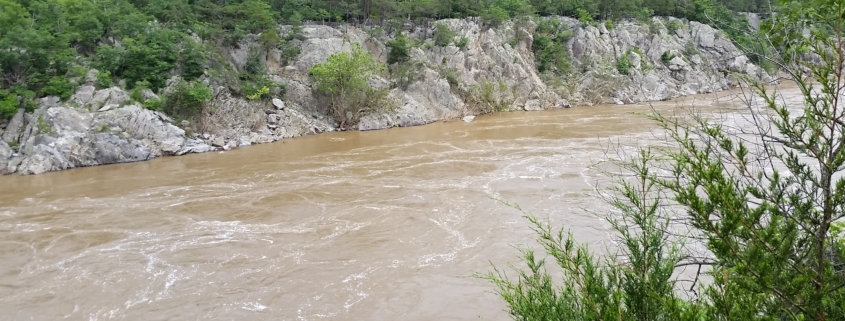
Feature photo by author; Mather Gorge.This gorge runs downriver from Great Falls. Steep walls funnel the Potomac River down to a narrow width. The relatively straight shape may be due to the Potomac following a fault line (fracture) and caused by progressive erosion as the falls dug backwards.

Article by FMN Stephen Tzikas

Geology is an inherent part of all trails. Some trails may have unique geological features.  However, all trails in Fairfax County and Northern Virginia share a similar geological history.  Virginia’s geology is that of orogeny, or mountain building, in more common terms. Virginia’s orogeny followed cycles. The Grenville Orogeny marked the amalgamation of the supercontinent Rodinia, about 1.3 to 1.1 billion years ago.  Rodinia’s rifting (i.e., breakup) began about 1 billion years ago.  So began a cycle, called the Wilson Cycle. The Wilson Cycle, or the cyclical opening and closing of ocean basins, can be explored at Great Falls Park.

After the Grenville Orogeny, there were three others.  The Taconic Orogeny commenced about 470 million years ago. This

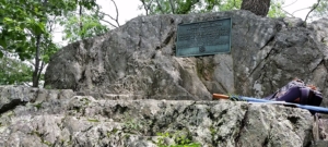
Photo by author; Rock with Washington Plaque

orogeny involved volcanic island chains in the Iapetus Ocean, as the ocean next to Virginia was then called. At about 420 million years ago, the Iapetus Ocean had completely closed and the combined mass of land formed the new continent of Laurasia.  This was followed by the Acadian Orogeny about 390 to 360 million years ago. This orogeny involved a collision of Avalon with eastern North America.  Finally, the Alleghenian Orogeny occurred about 300 to 250 million years ago. This orogeny resulted from a collision between North America and Africa.  This orogeny was a continent-continent collision that formed the supercontinent Pangea. Following the Alleghenian Orogeny, the supercontinent of Pangea eventually rifted and the Atlantic Ocean was created. Why did it start with Grenville and not before?  Well, Earth up until then was a very active place with the process of plate tectonics and continental landmasses still in development.

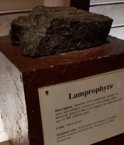
Photo by author; Lamprophyre at the Great Falls Park Museum, formed during the Acadian Orogeny

At Great Falls Park one can find evidence for the deposition of turbidites from the Grenville Mountains into the Iapetus Ocean.  Turbidites are underwater avalanches which slide down the steep slopes of the continental shelf edge. These turbidite deposits underwent metamorphism and up thrusting into the rocks of Great Falls Park.  At one of the park’s landmarks, a rock with a George Washington memorial plaque is found. This rock has alternating layers of metamorphic mica schist and metamorphic metagraywacke turbidite deposit. More precisely, these were formed when sedimentary layers became destabilized and fell from the slopes of the continental shelf into deep ocean waters. These sediments were transported and deposited by density flow, not by tractional or frictional flow. That is, the coarser material settled first, the finer particulate matter followed.

Not as old as the turbidites, Granite too was push up unto the continent during the

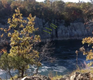
Photo: Nanette Nyce, NPS website; Lamprophyre dikes in Mather Gorge. Yellow arrows point to dikes.

Taconic Orogeny.  In further orogeny events, the area of Great Falls was active with volcanoes.  About 360 million years ago Lamprophyre intruded into the fractures and dykes of older formations. The Lamprophyre rock was a volcanic igneous mica and feldspar and cooled upon reaching the surface.  Many of these rock types are on display at the Great Falls Park museum. The Lamprophyre Dikes can be seen near the head of Mather Gorge, just south of Rocky Islands.  They are a striking series of dark, vertical lines visible on both sides of the Potomac River.

When the last rifting occurred about 200 million years ago, faulting occurred as well as jointing.  The latter are fractures in rock, unlike a fault, which involves displacement. Joints can form due to cooling, shrinkage, or tectonic forces.  Jointing too can be as seen at Great Falls Park.  During this last phase rivers started flowing eastward again, sediments started flowing into the Atlantic, and the Potomac River may have started forming. About 3 million years ago the Ice Age began, and ice as high as 2 miles would cover NYC and Chicago. About 20,000 years ago, the ice age started thawing. While the Potomac was flowing during the ice age, its flow would begin to slow as its gradient would decrease as sea levels rose and further erosion of the Appalachian Mountains occurred.

Follow the Spring Bird Migration with the BirdCast Migration Dashboard!

Photo: Purple Martins, Keith Kingdon/Audubon Photography Awards

The new BirdCast Migration Dashboard provides summaries of radar-based measurements of nocturnal bird migration, including estimates of the total number of birds migrating, their directions, speeds, and altitudes. This tool depicts migration patterns in near real time or as a summary of a whole night after nocturnal periods end (2021-present); this includes additional historical information (2013-2021) as well as previous nights’ movements. Note that the dashboard currently provides data for counties and states in the contiguous US, complementing the existing forecast and live migration maps but allowing you to explore nocturnal bird migration in ways that were previously impossible. As your explorations begin, discovering interesting, new and previously unknown patterns will be, perhaps, the most exciting aspects of the new tool!

This tool presents a number of different measures of bird migration, and the descriptions below provide some basic information and guidance for interpreting these appropriately. Type in the county or state of your choice in the contiguous United States, select a date during migration seasons in 2021 or 2022, and begin! If you are new to BirdCast, get acquainted with the basics: How to use the BirdCast Migration Dashboard to experience your local migration in detail.

BirdCast is a consortium of interdisciplinary researchers, primarily from three organizations at present, with a growing list of collaborators, supporters, and partners.


Core Partners: Cornell Lab of Ornithology, Colorado State University, and University of Massachusetts Amherst
Core funders: National Science Foundation, Leon Levy Foundation, and Amazon Web Services
Other support: NOAA, US Geological Survey, National Fish and Wildlife Foundation, NASA, Microsoft
Other partners: Houston Audubon Society, Perot Museum, Dallas Zoo


Early Spring Blooms for The Garden

Photo: Plant NOVA Natives

Article by Plant NOVA Natives

Our woodlands and meadows are about to awaken and burst into a vibrant display of spring ephemerals, the transient native beauties we love to see, especially after the cold and snowy days of winter. They are among the first spring plants to emerge and are indeed ephemeral. They don’t last long, completing their life cycle in a matter of weeks to take advantage of the sunlight that filters through the canopy before the trees leaf out.

Virginia Bluebells are a well known and popular example of a spring ephemeral, celebrated during Bluebell festivals around the region in April. But the show starts earlier, with Spring Beauty sprinkling  the ground starting in late March, followed by a whole array of fascinating species including Trout Lilies and Dutchman’s Breeches. We can bring their splendor and interest to our homes by planting them in our landscapes and gardens. They are the native equivalent of crocuses and daffodils, a difference being that they are transplanted in pots rather than planted as bulbs.

The blooms of spring ephemerals are small and delicate, almost fairy-like in appearance, and yet they are an important source of early pollen for newly emerging bees. Our gardens can serve as a haven for these small but mighty plants that directly support the biodiversity of the region. Spring ephemerals will emerge before many of us begin to actively garden, so successful cultivation requires some advance thought and planning. They need sun in late winter and early spring but require shade later on as the sun intensifies and temperatures rise. They will be at home in most woody settings on your property, so plant them under trees, shrubs, and other large perennials where the soil is moist. They are particularly charming along paths and walkways where you can enjoy them every day as you pass by. You can read about them on the Plant NOVA Natives website.

Some growers advise that early fall is the best time to plant spring ephemerals, but the plants are harder to find for sale then since they would just look like empty pots. Planting them in the spring is just fine, but you may not see blooms in the first season. Most commercial nurseries these days sell the more popular species of spring ephemerals such as Virginia Bluebell, but a wider selection of species can be found in the native plant nurseries and at the local spring native plant sales.

Please remember this important rule when considering spring ephemerals for your property. You should always buy them from a grower and never take them from the wild. They are slow to propagate and will likely die if you disturb them. They may be small and short lived, but they are crucial to the native ecosystems and a testament to the renewal of spring. Let’s enjoy them in the wild where they have decided to plant themselves.

Before this year’s spring ephemerals come and go, it’s worth the effort to get out and see them sprinkled across wetlands and woodland floors in parks and other undisturbed preserves across Northern Virginia. They are a sight for sore eyes after the drab gray of winter. Open your plant identification apps, grab your native plant guidebook, or go on one of the spring ephemeral walks such as the ones hosted by the Virginia Native Plant Society. Watch your step and stay on the paths as you take in the wonderful display. Get to know them, fall under their spell, and you will no doubt be inspired to purchase and plant several of these magical beauties for your own garden viewing pleasure.

Engineering on the Trail

Photo: The Potomac Canal at Great Falls Park, NPS by A. Toure

Article and photos by FMN Stephen Tzikas, except as noted

There are a lot of “roadside engineering” ruins found along roads and trails.  I like to visit them when I travel to nearby states. Typically these engineering ruins include iron furnaces, canals, and grist mills, but may include other interesting relics of industrial archaeology. We have such places in Fairfax County.

The ruins of Matildaville

At Great Falls Park, the geology of the area gave rise to engineering associations. River processes involve many engineering principles related to fluid mechanics. Rivers, too, offer opportunities for the application of geology for engineering works such as transport and power generation. Here in Great Falls Park, a complex of ruins are associated with a canal.  The ruins of Matildaville are located along one of the trails. It was a town associated with a canal built next to the Potomac River.  The ruins date from 1790, when the town was planned as an industrial community which would support canal operations. The town started as a staging and headquarters area for the construction of a canal. The town included a forge, a gristmill, a store, storage buildings, the superintendent’s house, a market, a sawmill, an ice house, worker barracks, boarding houses, a few smaller homes, and an inn.  Construction of the canal took 17 years, becoming operational in 1802. However, the Patowmack Company succumbed in 1828, turning over its assets and liabilities to the newly formed Chesapeake and Ohio Canal Company, whose canal ruins are also in the nearby area.  Alas the town did not survive the closing of the canal in 1830.  Eventually all canals were made obsolete by the railroad.

A Potomac Canal Lock at Great Falls Park

The stone ruins of an upstream portion of the Potomac Canal at Great Falls Park usually does not have water flowing in it, but on rare occasions it does.  Canal ruins that are usually seen, such at Great Falls Park, are of locks.  A boat going down stream entered a lock at its upper end.  At the lower end a gate kept the water in.  The upper gate was then closed.  Values in the lower gate were opened to lower the water level to the next lock downstream.  The lower gate was opened and the boat proceeded to the next lock.  For boats going upstream, the procedure was reversed.  If a location had a mountain lake such as the Morris Canal in New Jersey, these engineering marvels could even literally cross over a mountain!


Clean Water and Native Plants

Article by Plant NOVA Natives; Image: https://jamesriverconsortium.org

If your property contains a stream, pond, or any sort of wetland, whether its flow is permanent or intermittent in nature, this article is especially for you! Anyone can directly enhance water quality, and in turn benefit the health of the animal, plant, and human communities that depend upon it, by using native plants to fill the “riparian buffer” adjacent to a water feature. The word “riparian” comes from a Latin word meaning “bank.” A riparian buffer protects the wetland from runoff from developed areas, including turfRegrass lawns.

If the riparian buffer already contains natural vegetation, you should first control any invasive plants found there.You should also avoid adding any new species, native or otherwise, that will disturb the existing plant community. You may need a waiver from your County to remove existing vegetation and to plant new plants within 100 feet of a stream, shore, or wetland. Maps of these “Resource Protection Areas” can be found here. If the area is currently landscaped or mowed, you may be able to add native plants without a waiver, but you should still check with your county or municipal government.

To figure out if the plants that are present are native or invasive, you can use a free app such as iNaturalist or a subscription-based app such as PictureThis to help you with the identification. You can also invite a volunteer from the Northern Virginia Bird Alliance Wildlife Sanctuary Program to walk the site with you.

Healthy riparian buffers with native plants are beautiful to see and fun to explore. They support a wide diversity of life and create peaceful and inviting landscapes that draw us in to enjoy and connect with the nature they support.

Riparian buffers are also the natural defenders of stream banks. They help stabilize the soil and control soil erosion. This is due to their capacity to slow down and absorb stormwater runoff that would otherwise erode the banks of streams and rivers and fill the Chesapeake Bay with excessive silt. Due to riparian buffer degradation and excessive runoff across Northern Virginia, a massive quantity of silt from our streams and rivers now reaches the Chesapeake where it clogs the gills of wildlife, smothers eggs, buries aquatic insect habitats, and interferes with the production of oxygen by aquatic plants. Anything we do that successfully holds soil will benefit the Bay. Riparian buffers also act as filters that trap pollutants. This protects aquatic life from harmful contaminants and keeps them out of our water supply. Native trees provide the leaves that feed aquatic insects, and their shade lowers the water temperatures, making the environment more hospitable for life. As the earth warms, planting and protecting native plants on riparian borders will become increasingly urgent.

Ideally a riparian buffer should be at least 100 feet wide, but don’t let that discourage you, as a buffer of any size is helpful. Try to pick combinations of native plants that would naturally occur along waterways in your region. This will increase the odds of creating a balanced healthy habitat that continues to grow and thrive. Please refer to the resources on the Plant NOVA Natives website to help you select your plants.

Riparian buffers formed naturally on undisturbed land, holding soil, cooling water, filtering pollutants, and supporting life. It is humans who have disturbed them. Our work now is to take a moment to pause and wonder at the interdependence of land, water, native plants, and animals. Regardless of the other forces at work to degrade our environment, we still have the power to rebuild essential habitats on the lands we control.