Engineering on the Trail
Photo: The Potomac Canal at Great Falls Park, NPS by A. Toure
Article and photos by FMN Stephen Tzikas, except as noted
There are a lot of “roadside engineering” ruins found along roads and trails. I like to visit them when I travel to nearby states. Typically these engineering ruins include iron furnaces, canals, and grist mills, but may include other interesting relics of industrial archaeology. We have such places in Fairfax County.
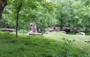
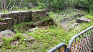
The ruins of Matildaville
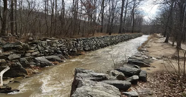
At Great Falls Park, the geology of the area gave rise to engineering associations. River processes involve many engineering principles related to fluid mechanics. Rivers, too, offer opportunities for the application of geology for engineering works such as transport and power generation. Here in Great Falls Park, a complex of ruins are associated with a canal. The ruins of Matildaville are located along one of the trails. It was a town associated with a canal built next to the Potomac River. The ruins date from 1790, when the town was planned as an industrial community which would support canal operations. The town started as a staging and headquarters area for the construction of a canal. The town included a forge, a gristmill, a store, storage buildings, the superintendent’s house, a market, a sawmill, an ice house, worker barracks, boarding houses, a few smaller homes, and an inn. Construction of the canal took 17 years, becoming operational in 1802. However, the Patowmack Company succumbed in 1828, turning over its assets and liabilities to the newly formed Chesapeake and Ohio Canal Company, whose canal ruins are also in the nearby area. Alas the town did not survive the closing of the canal in 1830. Eventually all canals were made obsolete by the railroad.
A Potomac Canal Lock at Great Falls Park
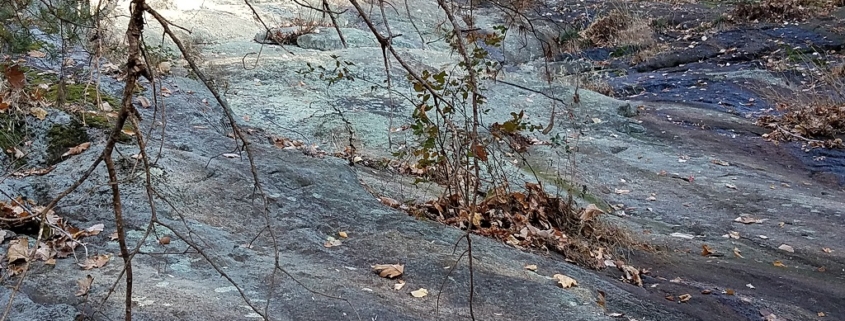
The stone ruins of an upstream portion of the Potomac Canal at Great Falls Park usually does not have water flowing in it, but on rare occasions it does. Canal ruins that are usually seen, such at Great Falls Park, are of locks. A boat going down stream entered a lock at its upper end. At the lower end a gate kept the water in. The upper gate was then closed. Values in the lower gate were opened to lower the water level to the next lock downstream. The lower gate was opened and the boat proceeded to the next lock. For boats going upstream, the procedure was reversed. If a location had a mountain lake such as the Morris Canal in New Jersey, these engineering marvels could even literally cross over a mountain!