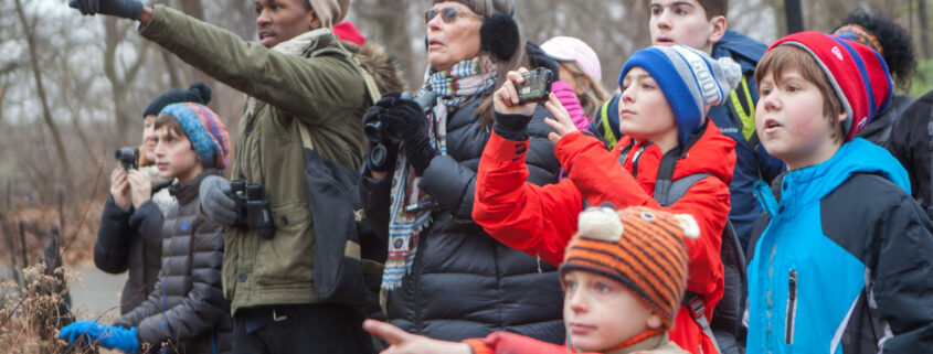
Audubon Christmas Bird Count (CBC) for 2025 Needs New Coordinators
Photo: FMN Lori Scheibe
Article by FMN Elaine Sevy
After many years, Su Jewell and Kurt Gaskill are stepping down as Audubon Christmas Bird Count coordinators, and are searching for new coordinators so the count for 2025 can go on.
Su was the Sector 10 coordinator, which included boundaries called “Lake Accotink,” described below. Kurt has served as the compiler for the Ft. Belvoir sector, also described below. Kurt is trying to set the date for the count this year. It’s not definite, but it’s likely to be either Jan. 3 or 4 (2026).
Su is willing to set up the new coordinator for Sector 10 and can be reached via email at naturewrite@yahoo.com. Please contact her directly if you’d like to help keep this tradition alive, and continue compiling important data for Lake Accotink and the Ft. Belvoir sector.
Here are the boundaries of Su’s area, Sector 10, which is called “Lake Accotink” but covers the surrounding areas:
Sector 10 – “Lake Accotink”
E to I-495 and I-95, S to Pohick Rd
Pohick Rd NW to Fairfax Co. Parkway, NW on Fairfax Co Pkwy to Burke Lake Rd
NE on Burke Lake Rd to Rolling Rd then angle to Braddock Rd near the intersection with Northhampton
N to Braddock Rd.
Includes L. Accotink, Accotink Stream Valley Park, Springfield G & CC, Pohick Stream Valley Park, Huntsman Lake, and Fort Belvoir Proving Grounds.
Su said some of the volunteers who have participated in past “Lake Accotink and Environs” CBC counts are available to assist this year as well. She can provide names and contact information. It’s also critical to recruit new volunteers.
Here’s the description for Kurt Gaskill’s responsibilities as Ft. Belvoir sector leader:
“First, appoint Sector Leaders familiar with the habitats and birds of a Sector. Ideally, a Sector Leader should take on the task for a few years (otherwise the compiler spends all of his/her time recruiting Leaders). Sector Leaders are responsible for recruiting volunteers, assigning routes, and collecting results which are then tallied and forwarded to the compiler. Currently, the Sectors are: Huntley Meadows, Fort Hunt, Mt Vernon, Fort Belvoir, Gunston, Mason Neck, the Maryland Potomac (Colonial Farms down thru Chapman Landing to Indian Head plus nearby marshes), Occoquan Bay NWR, Leesylvania, Burke Lake and Lake Accotink.
Second, obtain permission to count key areas such as the wildlife refuges and state parks. Sector Leaders often deal with the park level (and landfill) permissions. For permits to the refuges, the compiler contacts the biologist of the refuge, fills out the form for the permit and obtains the permit, lock codes, etc. All of this should be done relatively early – before Thanksgiving as the December holidays often make it difficult to finalize paperwork.