

New App Brings Awareness of ADA Requirements to Trails
Photos courtesy of Stephen Tzikas
Article written by FMN Steve Tzikas
Reprinted with permission of Audubon Society of Northern Virginia
As we celebrate Birdability Week, October 18 – October 24, 2021, we would like to highlight Steve Tzikas, an energetic volunteer who has been mapping trails in Northern Virginia for their “Birdability.”
“The Birdability Map is a crowdsourced map which describes the accessibility features of birding locations all over the world. This allows people with accessibility challenges to find out in advance if a birding location is one they would like to visit.”
Read Steve’s account of his mapping experience:
In early 2021 I inquired if the Audubon Society of Northern Virginia needed any volunteers for a citizen science field project that involved exercise. As I got older I needed more exercise opportunities, but as a scientist and engineer, I wanted it to involve science to keep my interest. The response I received informed me about Birdability, which was founded in 2016 by Virginia Rose. As the Birdability website notes,
“Birdability works to ensure the birding community and the outdoors are welcoming, inclusive, safe and accessible for everybody.” They “focus on people with mobility challenges, blindness or low vision, chronic illness, intellectual or developmental disabilities, mental illness, and those who are neurodivergent, deaf or hard of hearing or who have other health concerns.”
A lot of information can already be found on the Internet about Birdability, including that found on its own website. Rather than repeat much which has already been noted by others, this article focuses on how a government regulation can become common knowledge to the public.
Accessibility is an important part of trail development, because it is key to ensuring that trails are available to all groups such as the elderly and people with disabilities. The first accessibility laws were enacted in 1968 under the Architectural Barriers Act (ABA) of 1968. The Americans with Disabilities Act (ADA) of 1990 prohibited discrimination based on disability.
After some thought the proposal to volunteer and evaluate trails for Birdability became an interesting prospect, even if not citizen science. Birdability still offered exercise by walking trails, but it also intrigued me. One of my many duties as an engineer over the years was the creation and review of facility design standards and agency policies as they related to specific requirements for the environment, safety, health, and security. These were technical requirements that few people, except professionals, ever see. Such regulations keep the public safe, even if they are not aware of their surroundings and the issues that impact them. Sometimes, during reviews, a rather broad-based standard could include many other requirements not necessarily for my attention, but for other professionals in collaborating offices. As such, I would see information pertaining to ADA requirements.
So, when I reviewed the Birdability template used in trail reviews, I thought about how this organization took a complicated regulation and converted it to an app for the public to use, educating them in the process. Moreover, this caught my interest, because as an engineer I also develop models that track government operations based on transactional data and the resource requirements that are part of those operations. Developing models based on big data is another item only professionals will do. But, Birdability developed a public app based on “dry” government requirements and made it appealing, useful, and educational.
The Birdability survey template covers the basic ADA requirements so people with accessibility challenges can access a reviewed trail quickly and get outside to experience the natural surroundings. When submitting a survey, reviewers are asked to comment on ADA aspects including parking, ramps, restrooms, and other accessible features as well as trail accessibility criteria such as surface(s), slope(s), shade, benches, gates, railings, steps, and viewing blinds.
The largest section is for any additional information. This connects the trail to the types of birds seen, seasonal conditions, width of trails, overall difficulty, wildlife activity, and so on. This is followed by a section for rating the location’s overall accessibility, and there is the ability to add photographs.
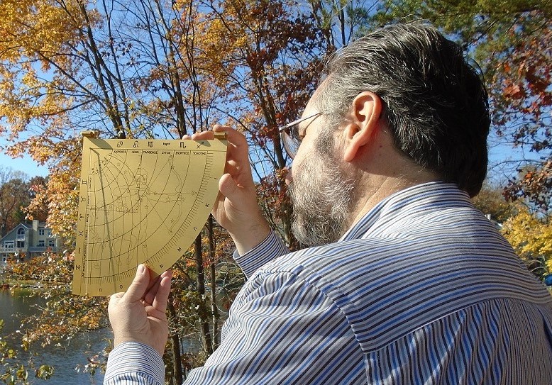
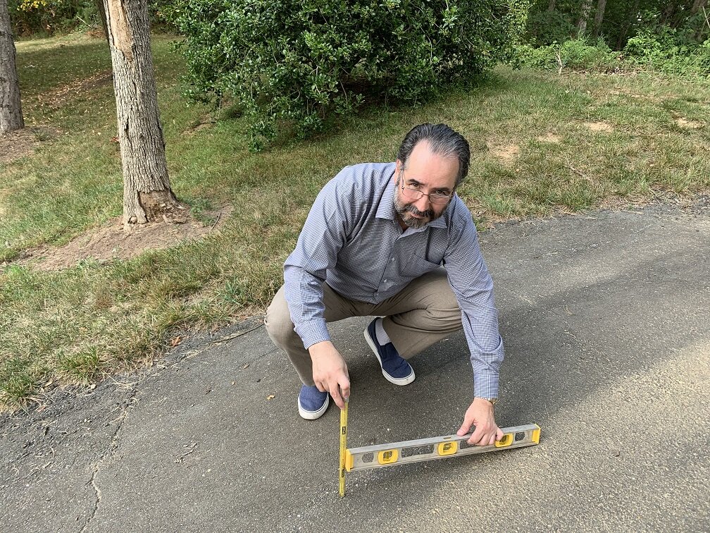
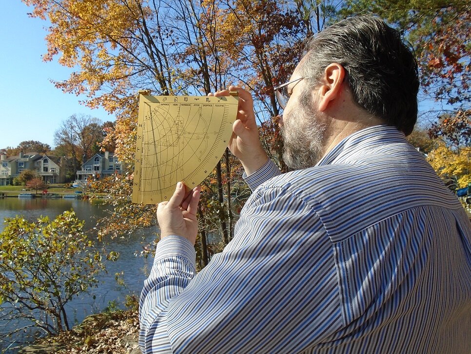
I forwarded suggestions for improvements, whether for future upgrades of the website itself, or to fellow reviewers on best practices for entering a review. For example; slope criteria are noted, but it’s not always an easy task to measure, especially if a trail has a lot of vertical variability. Reviewers can’t be expected to conduct an engineer’s transit measurement on every trail slope encountered. At first I attempted to measure the slope with the greatest incline. I used a simple astrolabe I owned to get a quick estimate for the degrees of inclination. However, it was even easier to take a photograph and post it so a reader could decide whether such inclines posed a challenge to their body strength or wheelchair. The photograph section of the survey template acted as a useful place to add information that words alone could not describe accurately. I also noted other ideas by including comments, such as whether a trail is accessible through public transportation.
While most people might associate ADA with people using wheel chairs, the ADA also covers conditions due to deafness, blindness, diabetes, cancer, epilepsy, intellectual disabilities, missing limbs, autism, and other medical conditions.
The accessibility guidelines apply to those trails that are designed and constructed for pedestrian use. These guidelines are not applicable to trails primarily designed and constructed for recreational use by equestrians, mountain bicyclists, snowmobile users, or off-highway vehicle users. Regulations also recognize the existence of constraints and limitations in the outdoor environment and allow for certain other exceptions.
I do many of my reviews in my town of Reston, Virginia. Reston was founded in 1964 as a planned community. Today it has 60,000 residents, over 55 miles of walking paths, about 250 acres of woodlands and open space, 4 lakes, and a tree canopy covering about half of its total area. There is a high degree of accessibility, and there are many birds along the paths and lakes. Birdability offers the chance to get to know your community and what it has to offer. The Birdability map notes the locations where people have submitted reviews. It is constantly growing with submissions.
If you are seeking a good experience with exercise and learning, Birdability mapping may be the one for you. Visit the website and view the Birdability map, where you can read what others wrote, as well as submit your own trail review. Whether it is a simple trail review, or a more thoughtful one that attempts to identify the variety of birds and their habits through the seasons, it’s worth a try.

